
10 Bus Route Map
View the 10 route map and see all 10 stops along the route. The map of 10 shows where the bus travels and the location of each stop, making it easy to understand the entire route at a glance.
Explore VINE Transit routes on the map and see where VINE Transit bus services operate. Use the 10 map to find bus stops and see how the 10 connects different areas along its trip.
All 10 stops on the map are displayed in route order, helping you follow the 10 bus from the first stop to the last.
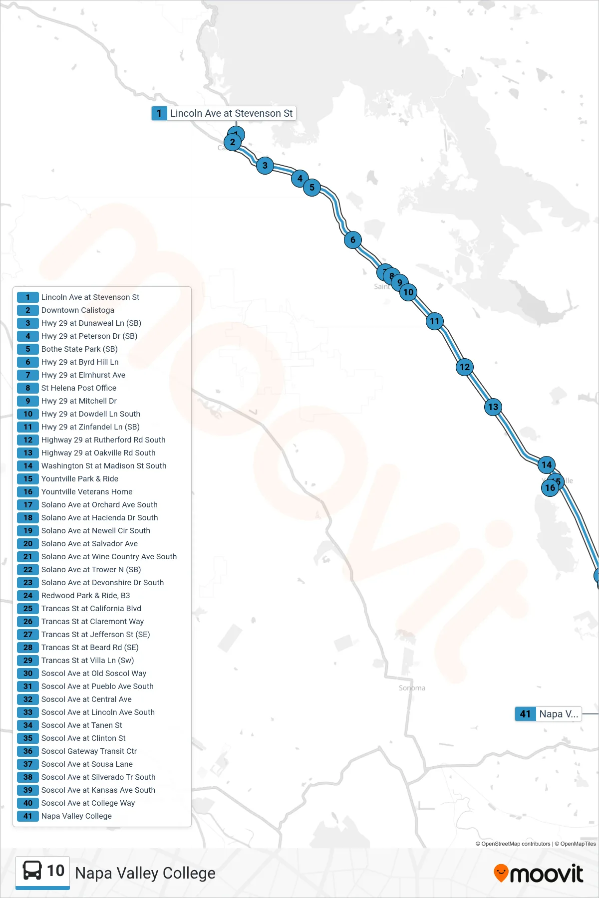
Stops list (10 - Napa Valley College)
- Lincoln Ave at Stevenson St
- Downtown Calistoga
- Hwy 29 at Dunaweal Ln (SB)
- Hwy 29 at Peterson Dr (SB)
- Bothe State Park (SB)
- Hwy 29 at Byrd Hill Ln
- Hwy 29 at Elmhurst Ave
- St Helena Post Office
- Hwy 29 at Mitchell Dr
- Hwy 29 at Dowdell Ln South
- Hwy 29 at Zinfandel Ln (SB)
- Highway 29 at Rutherford Rd South
- Highway 29 at Oakville Rd South
- Washington St at Madison St South
- Yountville Park & Ride
- Yountville Veterans Home
- Solano Ave at Orchard Ave South
- Solano Ave at Hacienda Dr South
- Solano Ave at Newell Cir South
- Solano Ave at Salvador Ave
- Solano Ave at Wine Country Ave South
- Solano Ave at Trower N (SB)
- Solano Ave at Devonshire Dr South
- Redwood Park & Ride, B3
- Trancas St at California Blvd
- Trancas St at Claremont Way
- Trancas St at Jefferson St (SE)
- Trancas St at Beard Rd (SE)
- Trancas St at Villa Ln (Sw)
- Soscol Ave at Old Soscol Way
- Soscol Ave at Pueblo Ave South
- Soscol Ave at Central Ave
- Soscol Ave at Lincoln Ave South
- Soscol Ave at Tanen St
- Soscol Ave at Clinton St
- Soscol Gateway Transit Ctr
- Soscol Ave at Sousa Lane
- Soscol Ave at Silverado Tr South
- Soscol Ave at Kansas Ave South
- Soscol Ave at College Way
- Napa Valley College