
100 Bus Route Map
View the 100 route map and see all 100 stops along the route. The map of 100 shows where the bus travels and the location of each stop, making it easy to understand the entire route at a glance.
Explore Regional Transportation District routes on the map and see where Regional Transportation District bus services operate. Use the 100 map to find bus stops and see how the 100 connects different areas along its trip.
All 100 stops on the map are displayed in route order, helping you follow the 100 bus from the first stop to the last.
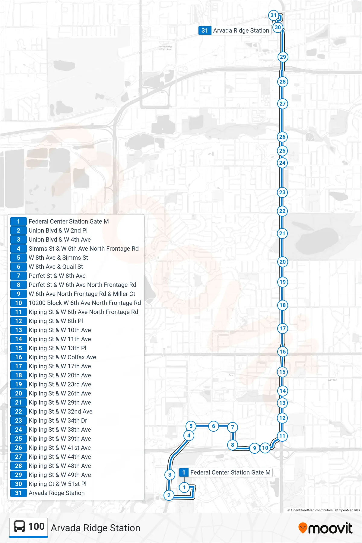
Stops list (100 - Arvada Ridge Station)
- Federal Center Station Gate M
- Union Blvd & W 2nd Pl
- Union Blvd & W 4th Ave
- Simms St & W 6th Ave North Frontage Rd
- W 8th Ave & Simms St
- W 8th Ave & Quail St
- Parfet St & W 8th Ave
- Parfet St & W 6th Ave North Frontage Rd
- W 6th Ave North Frontage Rd & Miller Ct
- 10200 Block W 6th Ave North Frontage Rd
- Kipling St & W 6th Ave North Frontage Rd
- Kipling St & W 8th Pl
- Kipling St & W 10th Ave
- Kipling St & W 11th Ave
- Kipling St & W 13th Pl
- Kipling St & W Colfax Ave
- Kipling St & W 17th Ave
- Kipling St & W 20th Ave
- Kipling St & W 23rd Ave
- Kipling St & W 26th Ave
- Kipling St & W 29th Ave
- Kipling St & W 32nd Ave
- Kipling St & W 34th Dr
- Kipling St & W 38th Ave
- Kipling St & W 39th Ave
- Kipling St & W 41st Ave
- Kipling St & W 44th Ave
- Kipling St & W 48th Ave
- Kipling St & W 49th Ave
- Kipling Ct & W 51st Pl
- Arvada Ridge Station