
100 Bus Route Map
View the 100 route map and see all 100 stops along the route. The map of 100 shows where the bus travels and the location of each stop, making it easy to understand the entire route at a glance.
Explore Nordland fylkeskommune routes on the map and see where Nordland fylkeskommune bus services operate. Use the 100 map to find bus stops and see how the 100 connects different areas along its trip.
All 100 stops on the map are displayed in route order, helping you follow the 100 bus from the first stop to the last.
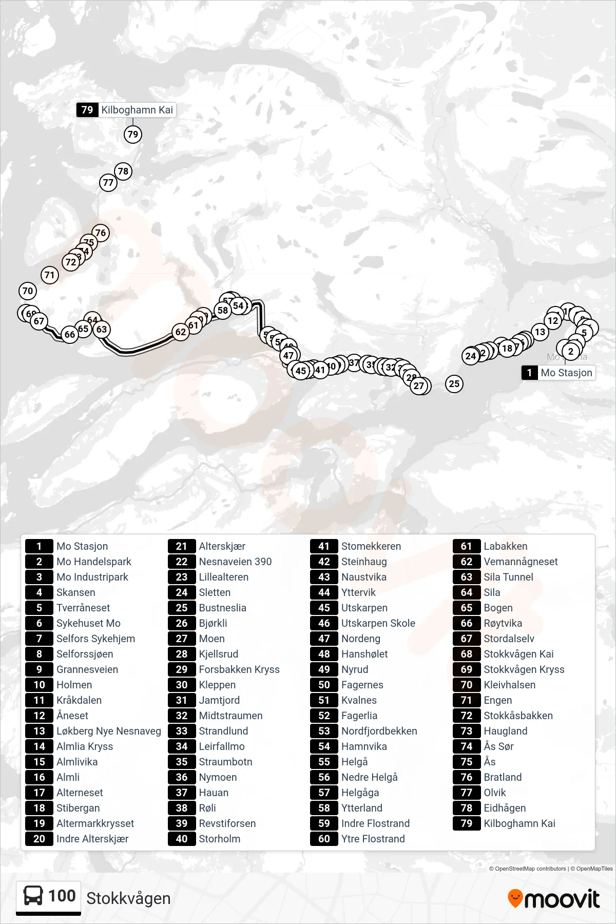
Stops list (100 - Stokkvågen)
- Mo Stasjon
- Mo Handelspark
- Mo Industripark
- Skansen
- Tverråneset
- Sykehuset Mo
- Selfors Sykehjem
- Selforssjøen
- Grannesveien
- Holmen
- Kråkdalen
- Åneset
- Løkberg Nye Nesnaveg
- Almlia Kryss
- Almlivika
- Almli
- Alterneset
- Stibergan
- Altermarkkrysset
- Indre Alterskjær
- Alterskjær
- Nesnaveien 390
- Lillealteren
- Sletten
- Bustneslia
- Bjørkli
- Moen
- Kjellsrud
- Forsbakken Kryss
- Kleppen
- Jamtjord
- Midtstraumen
- Strandlund
- Leirfallmo
- Straumbotn
- Nymoen
- Hauan
- Røli
- Revstiforsen
- Storholm
- Stomekkeren
- Steinhaug
- Naustvika
- Yttervik
- Utskarpen
- Utskarpen Skole
- Nordeng
- Hanshølet
- Nyrud
- Fagernes
- Kvalnes
- Fagerlia
- Nordfjordbekken
- Hamnvika
- Helgå
- Nedre Helgå
- Helgåga
- Ytterland
- Indre Flostrand
- Ytre Flostrand
- Labakken
- Vemannågneset
- Sila Tunnel
- Sila
- Bogen
- Røytvika
- Stordalselv
- Stokkvågen Kai
- Stokkvågen Kryss
- Kleivhalsen
- Engen
- Stokkåsbakken
- Haugland
- Ås Sør
- Ås
- Bratland
- Olvik
- Eidhågen
- Kilboghamn Kai
Change direction
- Route Map - 100 - Langset Kryss
- Route Map - 100 - Rana U Via Båsmo Skole
- Route Map - 100 - Nesna
- Route Map - 100 - Utskarpen
- Route Map - 100 - Tonnes
- Route Map - 100 - Nesna/Tonnes
- Route Map - 100 - Kilboghamn
- Route Map - 100 - Mo I Rana Via Sykehuset Mo
- Route Map - 100 - Mo I Rana
- Route Map - 100 - Stokkvågen/Tonnes
- Route Map - 100 - Eidhågen
- Route Map - 100 - Stokkvågen
- Route Map - 100 - Stensland
- Route Map - 100 - Utskarpen