
100 Bus Route Map
View the 100 route map and see all 100 stops along the route. The map of 100 shows where the bus travels and the location of each stop, making it easy to understand the entire route at a glance.
Explore LK2 routes on the map and see where LK2 bus services operate. Use the 100 map to find bus stops and see how the 100 connects different areas along its trip.
All 100 stops on the map are displayed in route order, helping you follow the 100 bus from the first stop to the last.
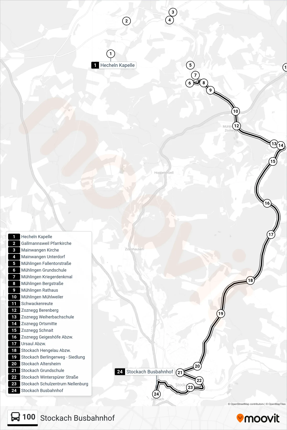
Stops list (100 - Stockach Busbahnhof)
- Hecheln Kapelle
- Gallmannsweil Pfarrkirche
- Mainwangen Kirche
- Mainwangen Unterdorf
- Mühlingen Fallentorstraße
- Mühlingen Grundschule
- Mühlingen Kriegerdenkmal
- Mühlingen Bergstraße
- Mühlingen Rathaus
- Mühlingen Mühlweiler
- Schwackenreute
- Zoznegg Berenberg
- Zoznegg Weiherbachschule
- Zoznegg Ortsmitte
- Zoznegg Schnait
- Zoznegg Geigeshöfe Abzw.
- Ursaul Abzw.
- Stockach Hengelau Abzw.
- Stockach Berlingerweg - Siedlung
- Stockach Altersheim
- Stockach Grundschule
- Stockach Winterspürer Straße
- Stockach Schulzentrum Nellenburg
- Stockach Busbahnhof