
100 Tram Route Map
View the 100 route map and see all 100 stops along the route. The map of 100 shows where the tram travels and the location of each stop, making it easy to understand the entire route at a glance.
Explore routes on the map and see where tram services operate. Use the 100 map to find tram stations and see how the 100 connects different areas along its trip.
All 100 stops on the map are displayed in route order, helping you follow the 100 tram from the first station to the last.
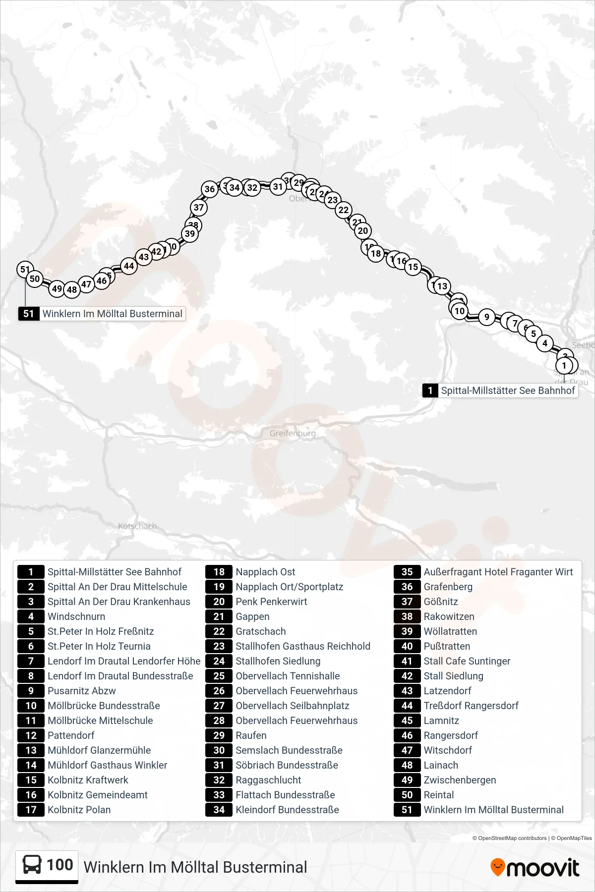
Stops list (100 - Winklern Im Mölltal Busterminal)
- Spittal-Millstätter See Bahnhof
- Spittal An Der Drau Mittelschule
- Spittal An Der Drau Krankenhaus
- Windschnurn
- St.Peter In Holz Freßnitz
- St.Peter In Holz Teurnia
- Lendorf Im Drautal Lendorfer Höhe
- Lendorf Im Drautal Bundesstraße
- Pusarnitz Abzw
- Möllbrücke Bundesstraße
- Möllbrücke Mittelschule
- Pattendorf
- Mühldorf Glanzermühle
- Mühldorf Gasthaus Winkler
- Kolbnitz Kraftwerk
- Kolbnitz Gemeindeamt
- Kolbnitz Polan
- Napplach Ost
- Napplach Ort/Sportplatz
- Penk Penkerwirt
- Gappen
- Gratschach
- Stallhofen Gasthaus Reichhold
- Stallhofen Siedlung
- Obervellach Tennishalle
- Obervellach Feuerwehrhaus
- Obervellach Seilbahnplatz
- Obervellach Feuerwehrhaus
- Raufen
- Semslach Bundesstraße
- Söbriach Bundesstraße
- Raggaschlucht
- Flattach Bundesstraße
- Kleindorf Bundesstraße
- Außerfragant Hotel Fraganter Wirt
- Grafenberg
- Gößnitz
- Rakowitzen
- Wöllatratten
- Pußtratten
- Stall Cafe Suntinger
- Stall Siedlung
- Latzendorf
- Treßdorf Rangersdorf
- Lamnitz
- Rangersdorf
- Witschdorf
- Lainach
- Zwischenbergen
- Reintal
- Winklern Im Mölltal Busterminal
Change direction
- Route Map - 100 - Winklern Im Mölltal Busterminal
- Route Map - 100 - Kolbnitz Bahnhof
- Route Map - 100 - Obervellach Seilbahnplatz
- Route Map - 100 - Lamnitz
- Route Map - 100 - Obervellach Seilbahnplatz
- Route Map - 100 - Spittal-Millstätter See Bahnhof
- Route Map - 100 - Möllbrücke Mittelschule
- Route Map - 100 - Kolbnitz Gemeindeamt
- Route Map - 100 - Heiligenblut Hotel Heiligenblut