
1014 Bus Route Map
View the 1014 route map and see all 1014 stops along the route. The map of 1014 shows where the bus travels and the location of each stop, making it easy to understand the entire route at a glance.
Explore Transporte e Turismo Iluminada routes on the map and see where Transporte e Turismo Iluminada bus services operate. Use the 1014 map to find bus stops and see how the 1014 connects different areas along its trip.
All 1014 stops on the map are displayed in route order, helping you follow the 1014 bus from the first stop to the last.
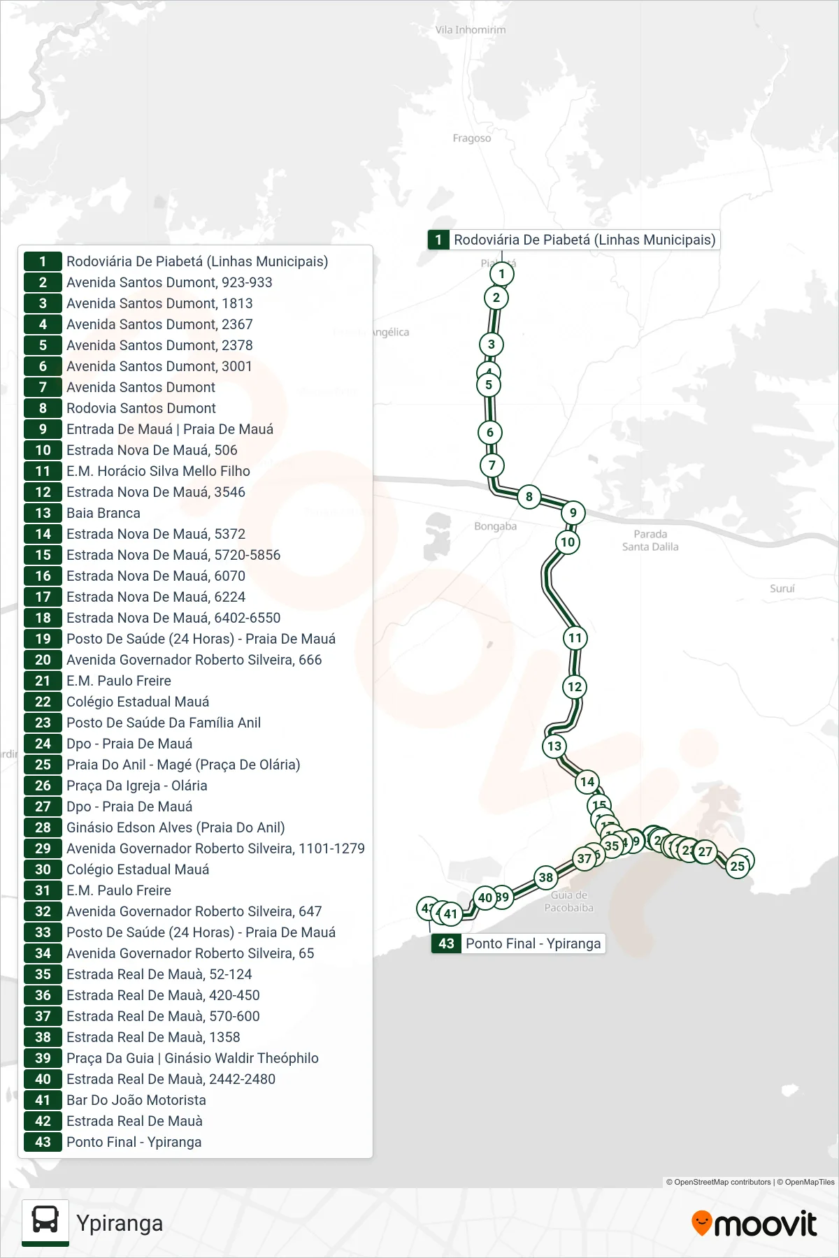
Stops list (1014 - Ypiranga)
- Rodoviária De Piabetá (Linhas Municipais)
- Avenida Santos Dumont, 923-933
- Avenida Santos Dumont, 1813
- Avenida Santos Dumont, 2367
- Avenida Santos Dumont, 2378
- Avenida Santos Dumont, 3001
- Avenida Santos Dumont
- Rodovia Santos Dumont
- Entrada De Mauá | Praia De Mauá
- Estrada Nova De Mauá, 506
- E.M. Horácio Silva Mello Filho
- Estrada Nova De Mauá, 3546
- Baia Branca
- Estrada Nova De Mauá, 5372
- Estrada Nova De Mauá, 5720-5856
- Estrada Nova De Mauá, 6070
- Estrada Nova De Mauá, 6224
- Estrada Nova De Mauá, 6402-6550
- Posto De Saúde (24 Horas) - Praia De Mauá
- Avenida Governador Roberto Silveira, 666
- E.M. Paulo Freire
- Colégio Estadual Mauá
- Posto De Saúde Da Família Anil
- Dpo - Praia De Mauá
- Praia Do Anil - Magé (Praça De Olária)
- Praça Da Igreja - Olária
- Dpo - Praia De Mauá
- Ginásio Edson Alves (Praia Do Anil)
- Avenida Governador Roberto Silveira, 1101-1279
- Colégio Estadual Mauá
- E.M. Paulo Freire
- Avenida Governador Roberto Silveira, 647
- Posto De Saúde (24 Horas) - Praia De Mauá
- Avenida Governador Roberto Silveira, 65
- Estrada Real De Mauà, 52-124
- Estrada Real De Mauà, 420-450
- Estrada Real De Mauà, 570-600
- Estrada Real De Mauà, 1358
- Praça Da Guia | Ginásio Waldir Theóphilo
- Estrada Real De Mauà, 2442-2480
- Bar Do João Motorista
- Estrada Real De Mauà
- Ponto Final - Ypiranga