
108 Bus Route Map
View the 108 route map and see all 108 stops along the route. The map of 108 shows where the bus travels and the location of each stop, making it easy to understand the entire route at a glance.
Explore SEPTA routes on the map and see where SEPTA bus services operate. Use the 108 map to find bus stops and see how the 108 connects different areas along its trip.
All 108 stops on the map are displayed in route order, helping you follow the 108 bus from the first stop to the last.
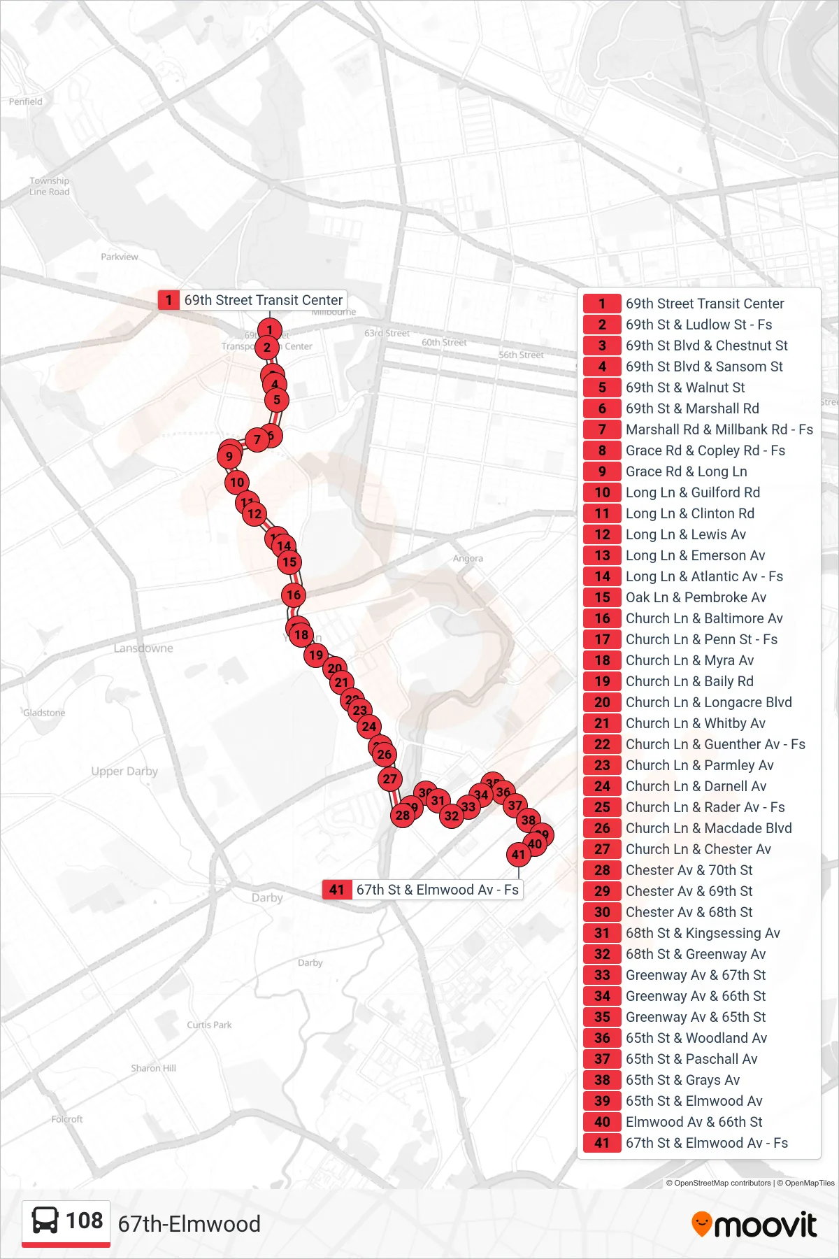
Stops list (108 - 67th-Elmwood)
- 69th Street Transit Center
- 69th St & Ludlow St - Fs
- 69th St Blvd & Chestnut St
- 69th St Blvd & Sansom St
- 69th St & Walnut St
- 69th St & Marshall Rd
- Marshall Rd & Millbank Rd - Fs
- Grace Rd & Copley Rd - Fs
- Grace Rd & Long Ln
- Long Ln & Guilford Rd
- Long Ln & Clinton Rd
- Long Ln & Lewis Av
- Long Ln & Emerson Av
- Long Ln & Atlantic Av - Fs
- Oak Ln & Pembroke Av
- Church Ln & Baltimore Av
- Church Ln & Penn St - Fs
- Church Ln & Myra Av
- Church Ln & Baily Rd
- Church Ln & Longacre Blvd
- Church Ln & Whitby Av
- Church Ln & Guenther Av - Fs
- Church Ln & Parmley Av
- Church Ln & Darnell Av
- Church Ln & Rader Av - Fs
- Church Ln & Macdade Blvd
- Church Ln & Chester Av
- Chester Av & 70th St
- Chester Av & 69th St
- Chester Av & 68th St
- 68th St & Kingsessing Av
- 68th St & Greenway Av
- Greenway Av & 67th St
- Greenway Av & 66th St
- Greenway Av & 65th St
- 65th St & Woodland Av
- 65th St & Paschall Av
- 65th St & Grays Av
- 65th St & Elmwood Av
- Elmwood Av & 66th St
- 67th St & Elmwood Av - Fs