
10E Bus Route Map
View the 10E route map and see all 10E stops along the route. The map of 10E shows where the bus travels and the location of each stop, making it easy to understand the entire route at a glance.
Explore Transport Board routes on the map and see where Transport Board bus services operate. Use the 10E map to find bus stops and see how the 10E connects different areas along its trip.
All 10E stops on the map are displayed in route order, helping you follow the 10E bus from the first stop to the last.
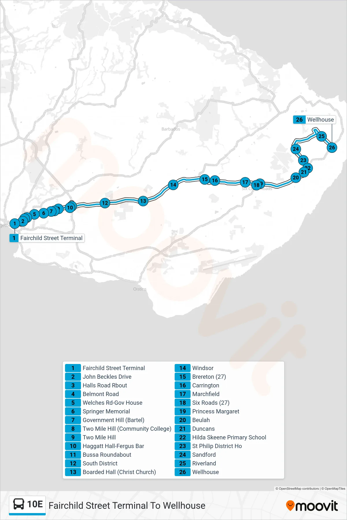
Stops list (10E - Fairchild Street Terminal To Wellhouse)
- Fairchild Street Terminal
- John Beckles Drive
- Halls Road Rbout
- Belmont Road
- Welches Rd-Gov House
- Springer Memorial
- Government Hill (Bartel)
- Two Mile Hill (Community College)
- Two Mile Hill
- Haggatt Hall-Fergus Bar
- Bussa Roundabout
- South District
- Boarded Hall (Christ Church)
- Windsor
- Brereton (27)
- Carrington
- Marchfield
- Six Roads (27)
- Princess Margaret
- Beulah
- Duncans
- Hilda Skeene Primary School
- St Philip District Ho
- Sandford
- Riverland
- Wellhouse