
10X Bus Route Map
View the 10X route map and see all 10X stops along the route. The map of 10X shows where the bus travels and the location of each stop, making it easy to understand the entire route at a glance.
Explore Rhode Island Public Transit Authority routes on the map and see where Rhode Island Public Transit Authority bus services operate. Use the 10X map to find bus stops and see how the 10X connects different areas along its trip.
All 10X stops on the map are displayed in route order, helping you follow the 10X bus from the first stop to the last.
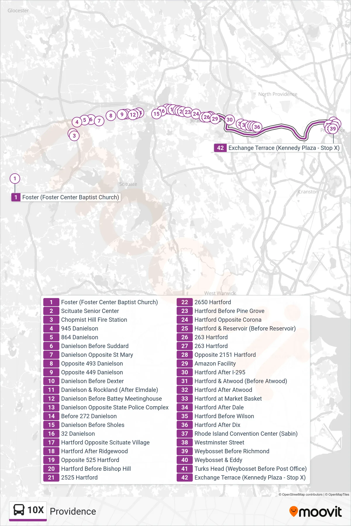
Stops list (10X - Providence)
- Foster (Foster Center Baptist Church)
- Scituate Senior Center
- Chopmist Hill Fire Station
- 945 Danielson
- 864 Danielson
- Danielson Before Suddard
- Danielson Opposite St Mary
- Opposite 493 Danielson
- Opposite 449 Danielson
- Danielson Before Dexter
- Danielson & Rockland (After Elmdale)
- Danielson Before Battey Meetinghouse
- Danielson Opposite State Police Complex
- Before 272 Danielson
- Danielson Before Sholes
- 32 Danielson
- Hartford Opposite Scituate Village
- Hartford After Ridgewood
- Opposite 525 Hartford
- Hartford Before Bishop Hill
- 2525 Hartford
- 2650 Hartford
- Hartford Before Pine Grove
- Hartford Opposite Corona
- Hartford & Reservoir (Before Reservoir)
- 263 Hartford
- 263 Hartford
- Opposite 2151 Hartford
- Amazon Facility
- Hartford After I-295
- Hartford & Atwood (Before Atwood)
- Hartford After Atwood
- Hartford at Market Basket
- Hartford After Dale
- Hartford Before Wilson
- Hartford After Dix
- Rhode Island Convention Center (Sabin)
- Westminster Street
- Weybosset Before Richmond
- Weybosset & Eddy
- Turks Head (Weybosset Before Post Office)
- Exchange Terrace (Kennedy Plaza - Stop X)