
11 Bus Route Map
View the 11 route map and see all 11 stops along the route. The map of 11 shows where the bus travels and the location of each stop, making it easy to understand the entire route at a glance.
Explore Start routes on the map and see where Start bus services operate. Use the 11 map to find bus stops and see how the 11 connects different areas along its trip.
All 11 stops on the map are displayed in route order, helping you follow the 11 bus from the first stop to the last.
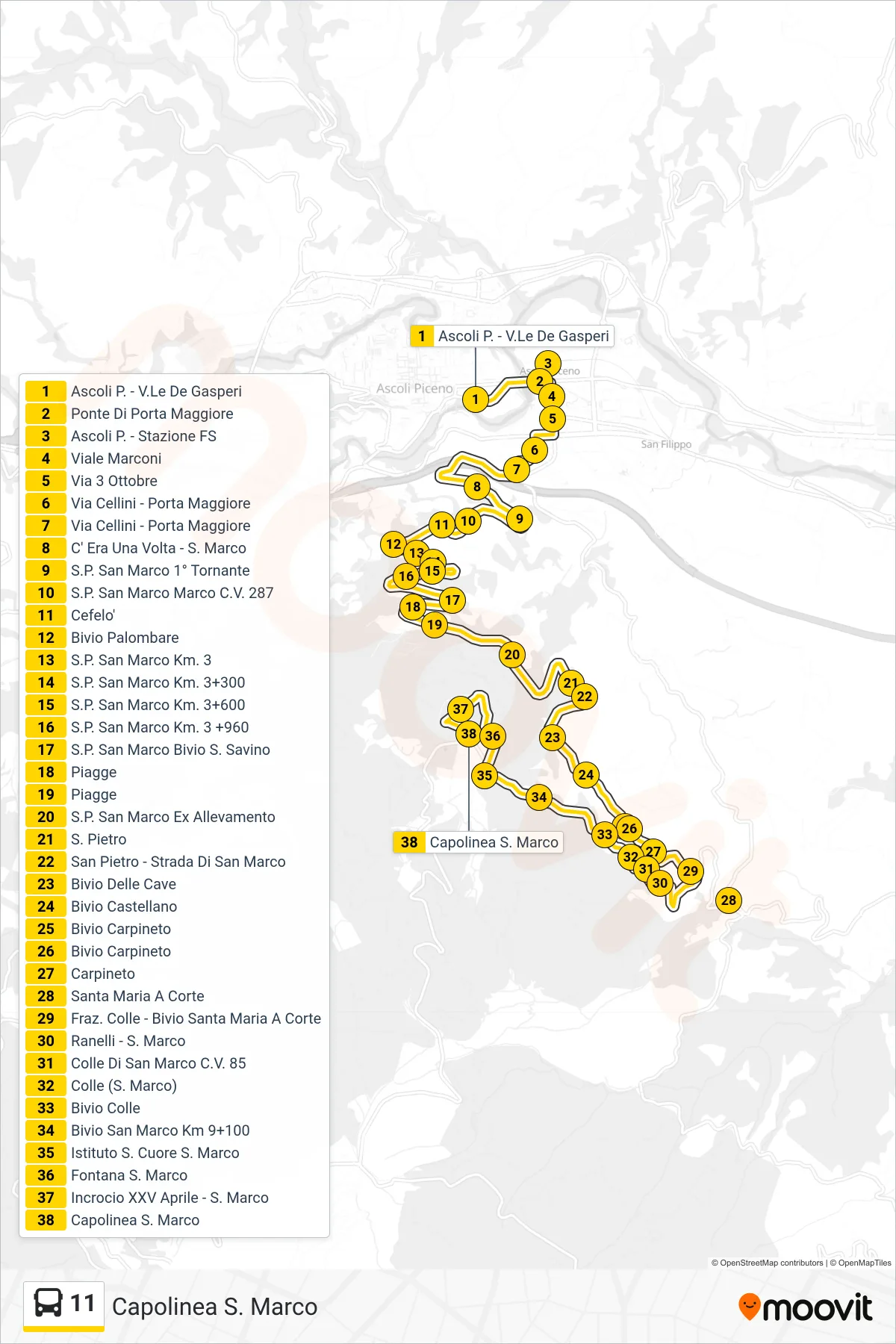
Stops list (11 - San Marco Terminal)
- Ascoli Piceno - De Gasperi Avenue
- Porta Maggiore Bridge
- Ascoli Piceno - Railway Station
- Marconi Avenue
- October 3rd Street
- Via Cellini - Main Gate
- Via Cellini - Main Gate
- Once Upon a Time - San Marco
- San Marco Provincial Road 1st Bend
- San Marco Provincial Road Marco C.V. 287
- Cefelo
- Palombare Junction
- St. Mark Provincial Road Km. 3
- San Marco Provincial Road Km 3+300
- SP San Marco Km 3+600
- San Marco Provincial Road Km 3 +960
- Provincial Road San Marco - San Savino Junction
- Piagge
- Piagge
- San Marco Provincial Rd Former Farm
- St. Peter
- San Pietro - San Marco Road
- Cave Junction
- Castellano Junction
- Carpineto Junction
- Carpineto Junction
- Carpineto
- Santa Maria A Corte
- Colle District - Santa Maria A Corte Junction
- Ranelli - St. Mark
- San Marco Hill C.V. 85
- Colle (St. Mark)
- Colle Junction
- San Marco Junction Km 9+100
- Sacred Heart Institute San Marco
- San Marco Fountain
- XXV April - San Marco Junction
- San Marco Terminal