
11 Bus Route Map
View the 11 route map and see all 11 stops along the route. The map of 11 shows where the bus travels and the location of each stop, making it easy to understand the entire route at a glance.
Explore The COMET routes on the map and see where The COMET bus services operate. Use the 11 map to find bus stops and see how the 11 connects different areas along its trip.
All 11 stops on the map are displayed in route order, helping you follow the 11 bus from the first stop to the last.
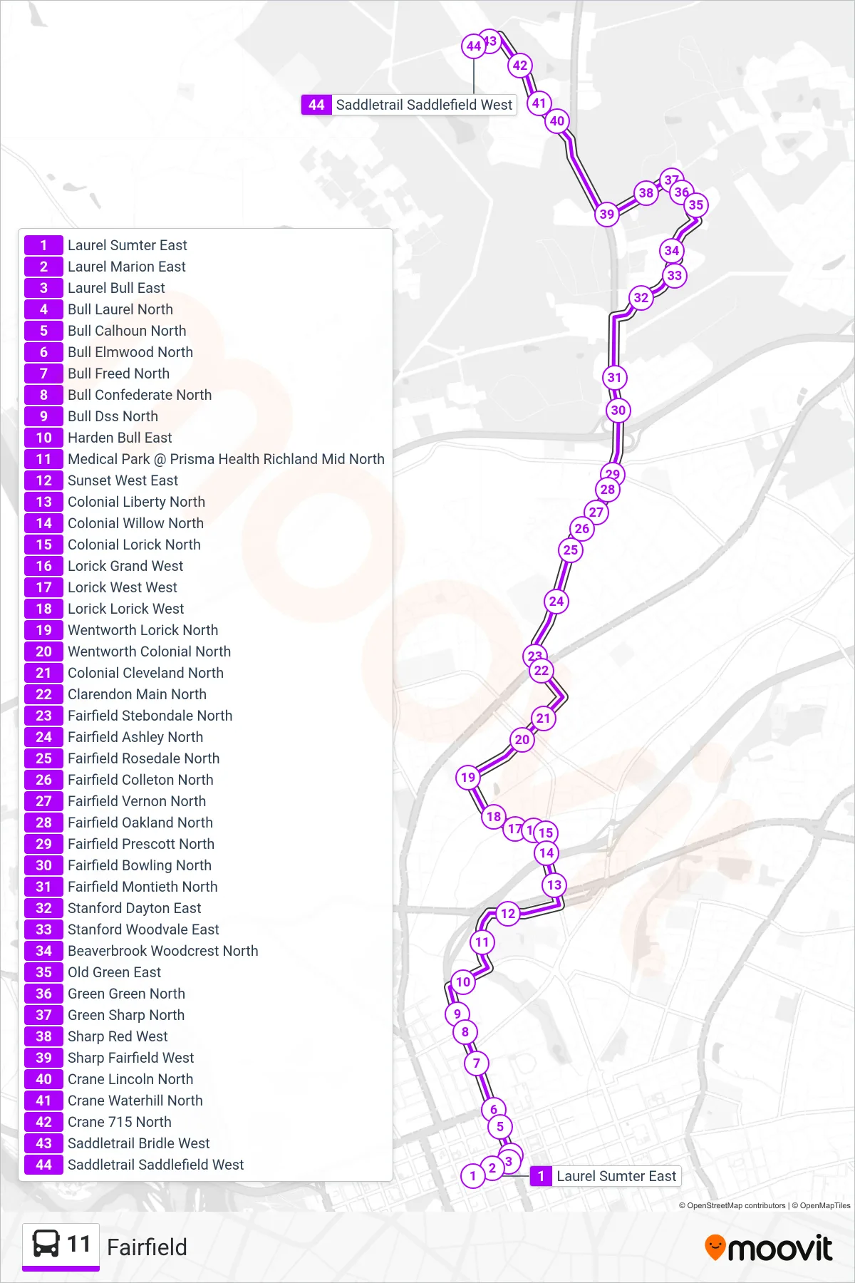
Stops list (11 - Colonial Heights / Fairfield Rd.)
- Laurel Sumter East
- Laurel Marion East
- Laurel Bull East
- Bull Laurel North
- Bull Calhoun North
- Bull Elmwood North
- Bull Freed North
- Bull Confederate North
- Bull Dss North
- Harden Bull East
- Medical Park @ Prisma Health Richland Mid North
- Sunset West East
- Colonial Liberty North
- Colonial Willow North
- Colonial Lorick North
- Lorick Grand West
- Lorick West West
- Lorick Lorick West
- Wentworth Lorick North
- Wentworth Colonial North
- Colonial Cleveland North
- Clarendon Main North
- Fairfield Stebondale North
- Fairfield Ashley North
- Fairfield Rosedale North
- Fairfield Colleton North
- Fairfield Vernon North
- Fairfield Oakland North
- Fairfield Prescott North
- Fairfield Bowling North
- Fairfield Montieth North
- Stanford Dayton East
- Stanford Woodvale East
- Beaverbrook Woodcrest North
- Old Green East
- Green Green North
- Green Sharp North
- Sharp Red West
- Sharp Fairfield West
- Crane Lincoln North
- Crane Waterhill North
- Crane 715 North
- Saddletrail Bridle West
- Saddletrail Saddlefield West