
11 Bus Route Map
View the 11 route map and see all 11 stops along the route. The map of 11 shows where the bus travels and the location of each stop, making it easy to understand the entire route at a glance.
Explore Regional Transportation District routes on the map and see where Regional Transportation District bus services operate. Use the 11 map to find bus stops and see how the 11 connects different areas along its trip.
All 11 stops on the map are displayed in route order, helping you follow the 11 bus from the first stop to the last.
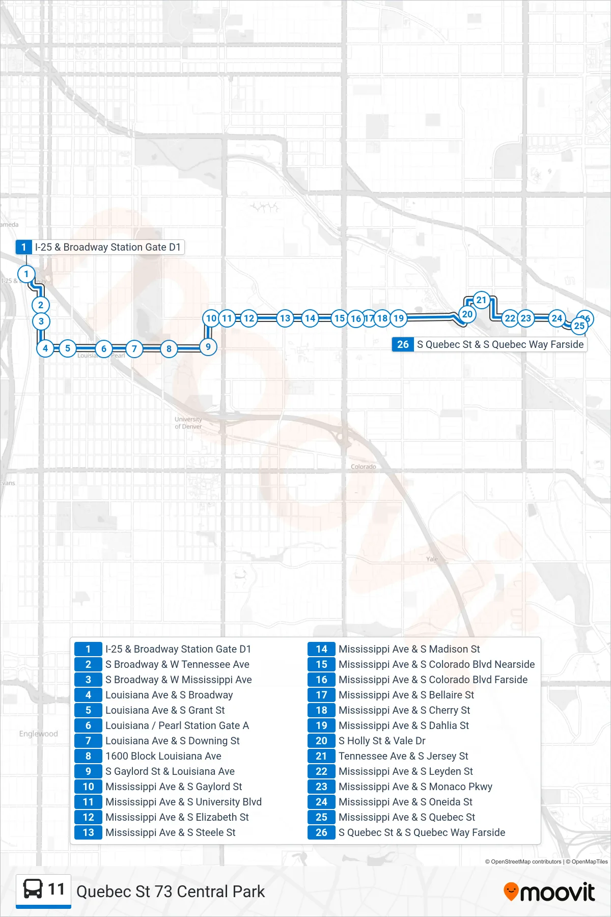
Stops list (11 - Quebec St 73 Central Park)
- I-25 & Broadway Station Gate D1
- S Broadway & W Tennessee Ave
- S Broadway & W Mississippi Ave
- Louisiana Ave & S Broadway
- Louisiana Ave & S Grant St
- Louisiana / Pearl Station Gate A
- Louisiana Ave & S Downing St
- 1600 Block Louisiana Ave
- S Gaylord St & Louisiana Ave
- Mississippi Ave & S Gaylord St
- Mississippi Ave & S University Blvd
- Mississippi Ave & S Elizabeth St
- Mississippi Ave & S Steele St
- Mississippi Ave & S Madison St
- Mississippi Ave & S Colorado Blvd Nearside
- Mississippi Ave & S Colorado Blvd Farside
- Mississippi Ave & S Bellaire St
- Mississippi Ave & S Cherry St
- Mississippi Ave & S Dahlia St
- S Holly St & Vale Dr
- Tennessee Ave & S Jersey St
- Mississippi Ave & S Leyden St
- Mississippi Ave & S Monaco Pkwy
- Mississippi Ave & S Oneida St
- Mississippi Ave & S Quebec St
- S Quebec St & S Quebec Way Farside