
11 Cable Car Route Map
View the 11 route map and see all 11 stops along the route. The map of 11 shows where the cable car travels and the location of each stop, making it easy to understand the entire route at a glance.
Explore KP Kyivpastrans routes on the map and see where KP Kyivpastrans cable car services operate. Use the 11 map to find cable car stations and see how the 11 connects different areas along its trip.
All 11 stops on the map are displayed in route order, helping you follow the 11 cable car from the first station to the last.
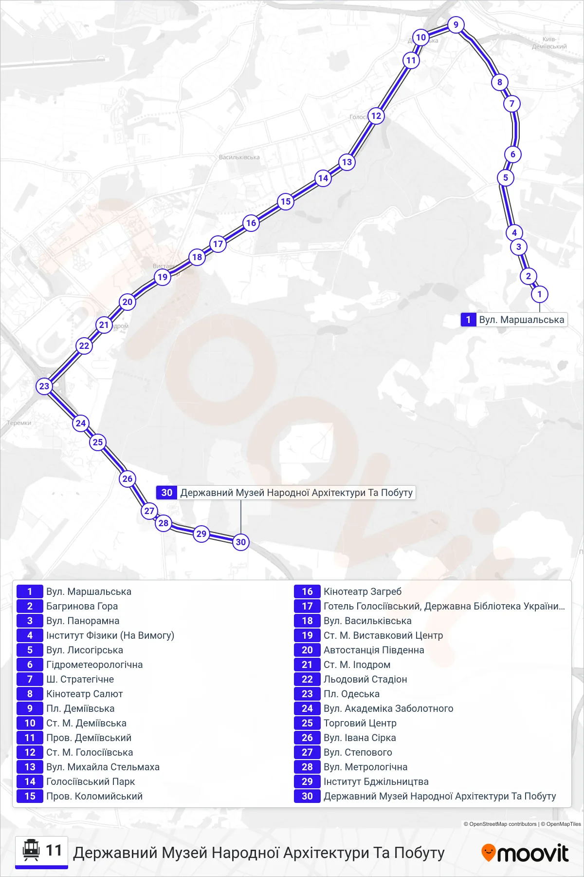
Stops list (11 - State Museum of Folk Architecture and Life)
- Marshalska Street
- Bahrynova Mountain
- Panoramna Street
- Institute of Physics (On Demand)
- Lysohirska Street
- Hydrometeorolohichna
- Stratehichne St.
- Salut Cinema
- Demiivska Square
- Demiivska Metro Station
- Demiivsky Lane
- Metro Station Holosiivska
- Mykhailo Stelmakh Street
- Holosiiv Park
- Kolomyiskyi Lane
- Zagreb Cinema
- Holosiivskyi Hotel, State Library of Ukraine for Youth
- Vasylkivska Street
- Metro Station Exhibition Center
- Southern Bus Station
- Ipodrom Metro Station
- Ice Stadium
- Odeska Square
- Academician Zabolotny Street
- Shopping Center
- Ivan Sirka St
- Stepovoho Street
- Metrolohichna Street
- Beekeeping Institute
- State Museum of Folk Architecture and Life