
11 Tram Route Map
View the 11 route map and see all 11 stops along the route. The map of 11 shows where the tram travels and the location of each stop, making it easy to understand the entire route at a glance.
Explore Rīgas satiksme routes on the map and see where Rīgas satiksme tram services operate. Use the 11 map to find tram stations and see how the 11 connects different areas along its trip.
All 11 stops on the map are displayed in route order, helping you follow the 11 tram from the first station to the last.
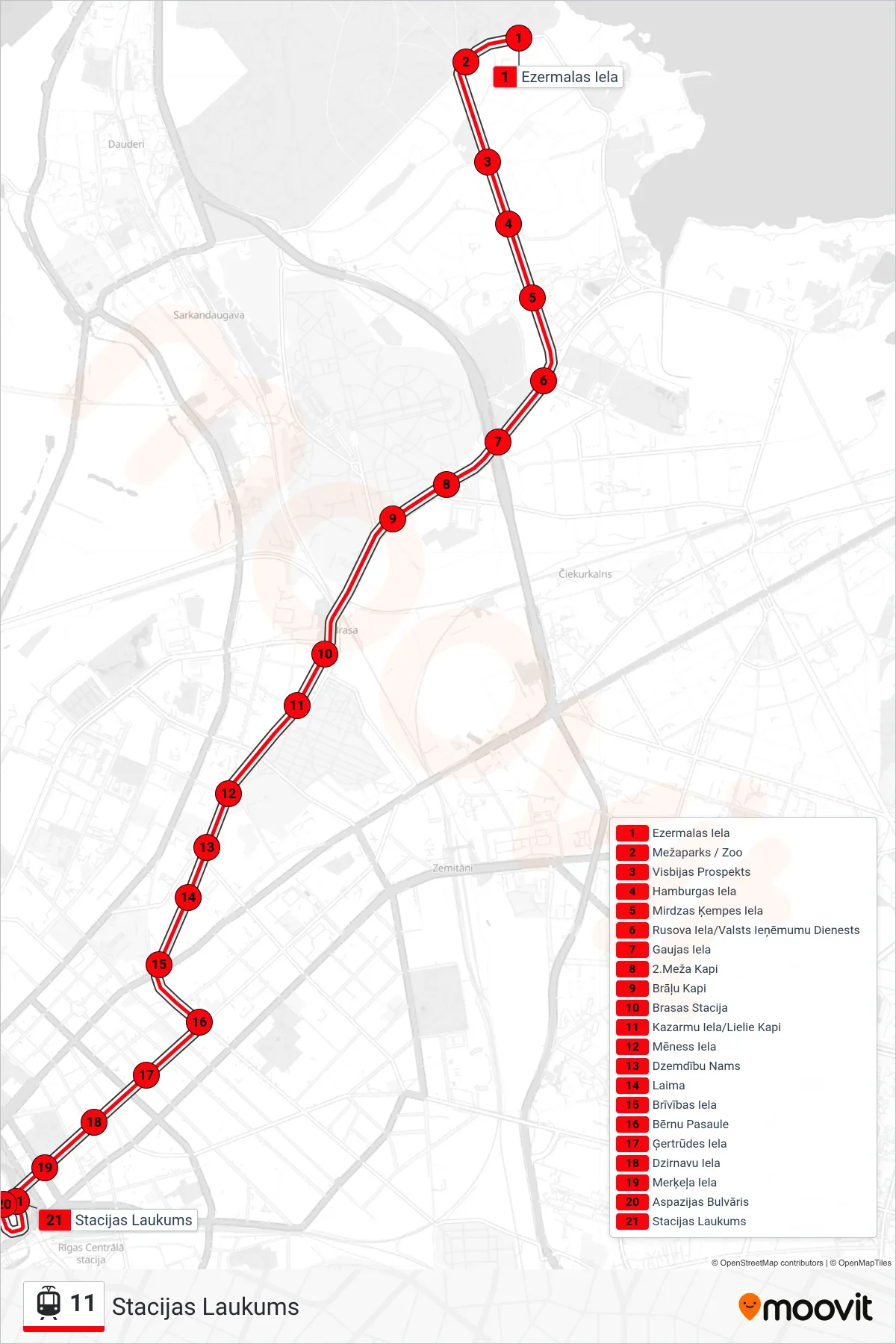
Stops list (11 - Stacijas Laukums)
- Ezermalas Iela
- Mežaparks / Zoo
- Visbijas Prospekts
- Hamburgas Iela
- Mirdzas Ķempes Iela
- Rusova Iela/Valsts Ieņēmumu Dienests
- Gaujas Iela
- 2.Meža Kapi
- Brāļu Kapi
- Brasas Stacija
- Kazarmu Iela/Lielie Kapi
- Mēness Iela
- Dzemdību Nams
- Laima
- Brīvības Iela
- Bērnu Pasaule
- Ģertrūdes Iela
- Dzirnavu Iela
- Merķeļa Iela
- Aspazijas Bulvāris
- Stacijas Laukums