
11 Bus Route Map
View the 11 route map and see all 11 stops along the route. The map of 11 shows where the bus travels and the location of each stop, making it easy to understand the entire route at a glance.
Explore GoRaleigh routes on the map and see where GoRaleigh bus services operate. Use the 11 map to find bus stops and see how the 11 connects different areas along its trip.
All 11 stops on the map are displayed in route order, helping you follow the 11 bus from the first stop to the last.
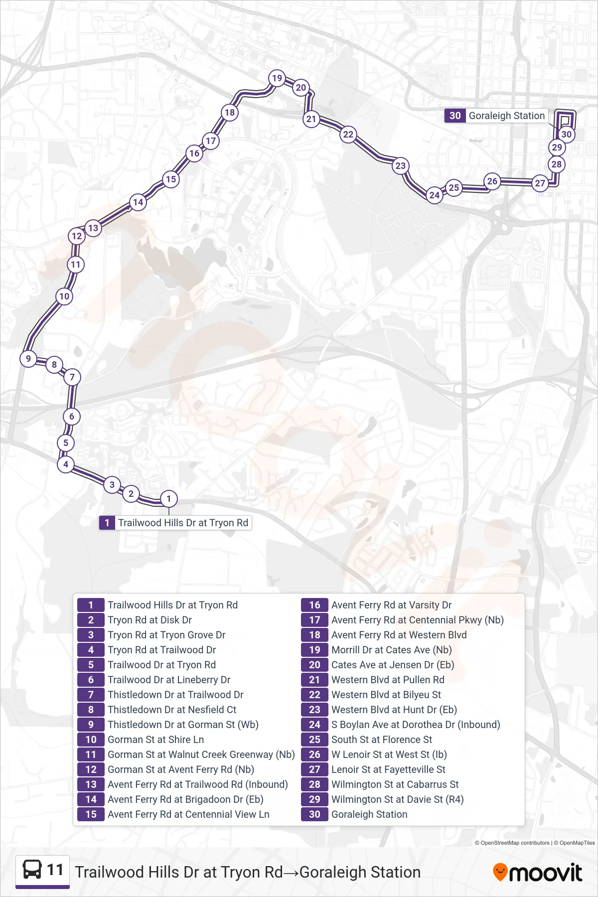
Stops list (11 - Trailwood Hills Dr at Tryon Rd→Goraleigh Station)
- Trailwood Hills Dr at Tryon Rd
- Tryon Rd at Disk Dr
- Tryon Rd at Tryon Grove Dr
- Tryon Rd at Trailwood Dr
- Trailwood Dr at Tryon Rd
- Trailwood Dr at Lineberry Dr
- Thistledown Dr at Trailwood Dr
- Thistledown Dr at Nesfield Ct
- Thistledown Dr at Gorman St (Wb)
- Gorman St at Shire Ln
- Gorman St at Walnut Creek Greenway (Nb)
- Gorman St at Avent Ferry Rd (Nb)
- Avent Ferry Rd at Trailwood Rd (Inbound)
- Avent Ferry Rd at Brigadoon Dr (Eb)
- Avent Ferry Rd at Centennial View Ln
- Avent Ferry Rd at Varsity Dr
- Avent Ferry Rd at Centennial Pkwy (Nb)
- Avent Ferry Rd at Western Blvd
- Morrill Dr at Cates Ave (Nb)
- Cates Ave at Jensen Dr (Eb)
- Western Blvd at Pullen Rd
- Western Blvd at Bilyeu St
- Western Blvd at Hunt Dr (Eb)
- S Boylan Ave at Dorothea Dr (Inbound)
- South St at Florence St
- W Lenoir St at West St (Ib)
- Lenoir St at Fayetteville St
- Wilmington St at Cabarrus St
- Wilmington St at Davie St (R4)
- Goraleigh Station