
11 Bus Route Map
View the 11 route map and see all 11 stops along the route. The map of 11 shows where the bus travels and the location of each stop, making it easy to understand the entire route at a glance.
Explore GoDurham routes on the map and see where GoDurham bus services operate. Use the 11 map to find bus stops and see how the 11 connects different areas along its trip.
All 11 stops on the map are displayed in route order, helping you follow the 11 bus from the first stop to the last.
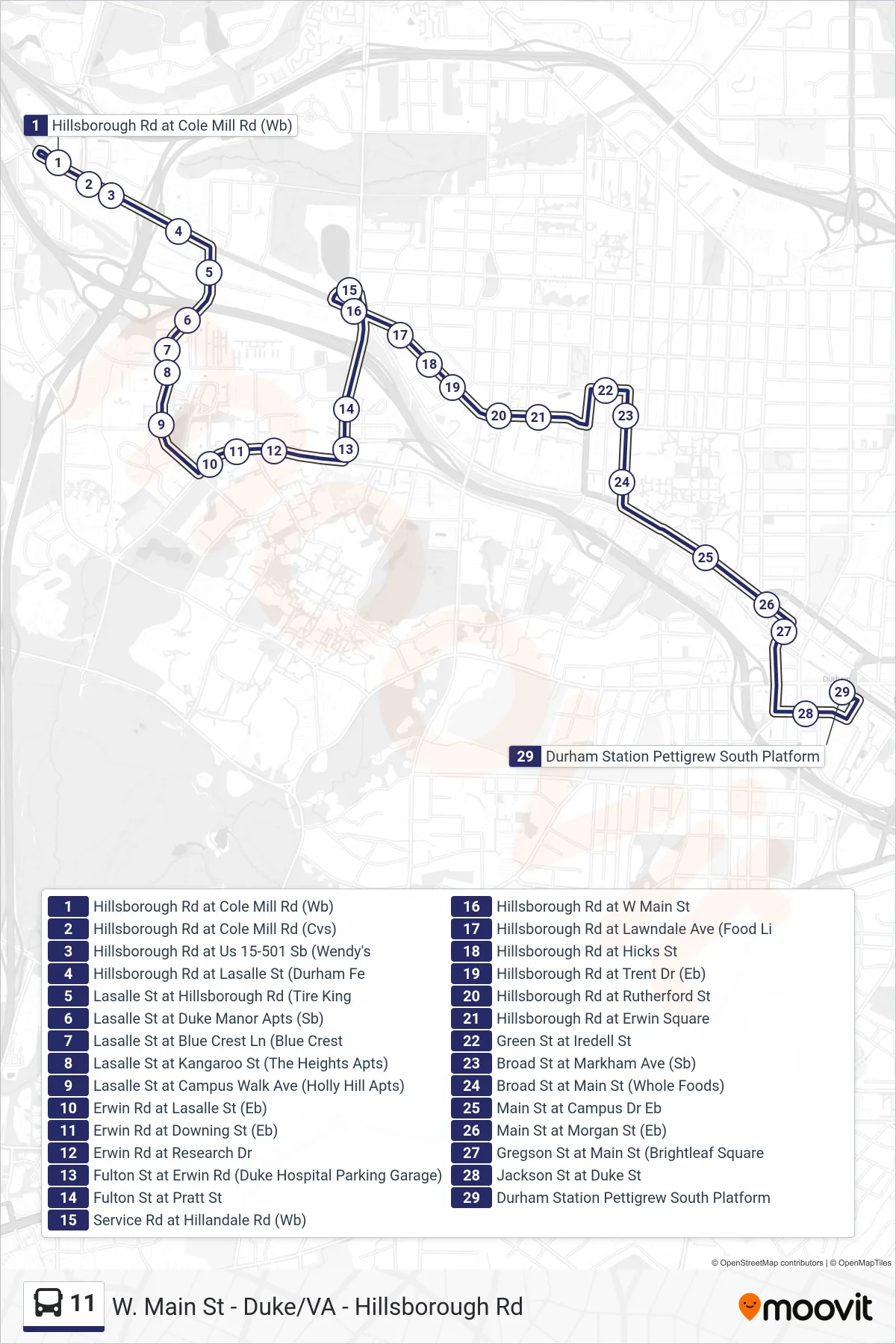
Stops list (11 - 11: Durham Station)
- Hillsborough Rd at Cole Mill Rd (Wb)
- Hillsborough Rd at Cole Mill Rd (Cvs)
- Hillsborough Rd at Us 15-501 Sb (Wendy's
- Hillsborough Rd at Lasalle St (Durham Fe
- Lasalle St at Hillsborough Rd (Tire King
- Lasalle St at Duke Manor Apts (Sb)
- Lasalle St at Blue Crest Ln (Blue Crest
- Lasalle St at Kangaroo St (The Heights Apts)
- Lasalle St at Campus Walk Ave (Holly Hill Apts)
- Erwin Rd at Lasalle St (Eb)
- Erwin Rd at Downing St (Eb)
- Erwin Rd at Research Dr
- Fulton St at Erwin Rd (Duke Hospital Parking Garage)
- Fulton St at Pratt St
- Service Rd at Hillandale Rd (Wb)
- Hillsborough Rd at W Main St
- Hillsborough Rd at Lawndale Ave (Food Li
- Hillsborough Rd at Hicks St
- Hillsborough Rd at Trent Dr (Eb)
- Hillsborough Rd at Rutherford St
- Hillsborough Rd at Erwin Square
- Green St at Iredell St
- Broad St at Markham Ave (Sb)
- Broad St at Main St (Whole Foods)
- Main St at Campus Dr Eb
- Main St at Morgan St (Eb)
- Gregson St at Main St (Brightleaf Square
- Jackson St at Duke St
- Durham Station Pettigrew South Platform