
11 Bus Route Map
View the 11 route map and see all 11 stops along the route. The map of 11 shows where the bus travels and the location of each stop, making it easy to understand the entire route at a glance.
Explore RTC RIDE routes on the map and see where RTC RIDE bus services operate. Use the 11 map to find bus stops and see how the 11 connects different areas along its trip.
All 11 stops on the map are displayed in route order, helping you follow the 11 bus from the first stop to the last.
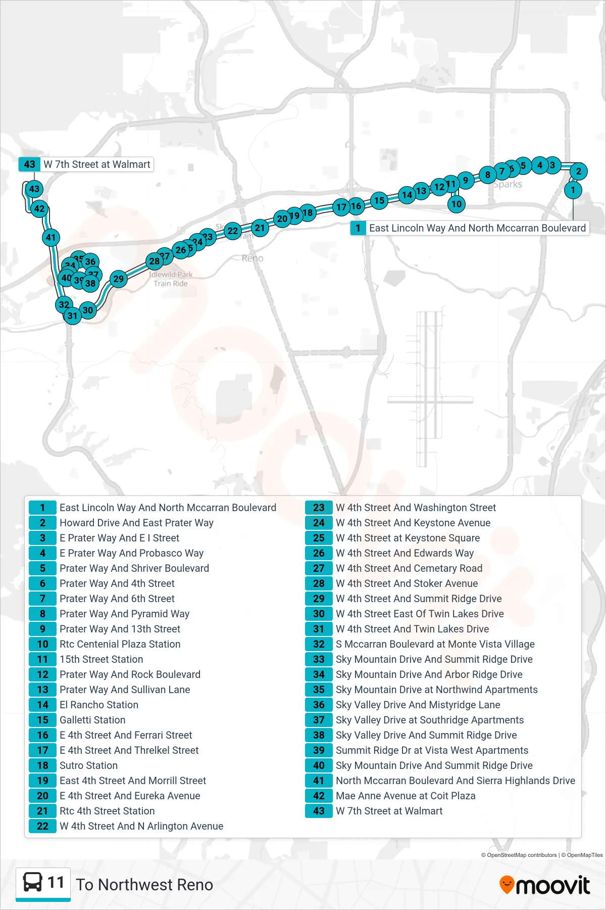
Stops list (11 - To Northwest Reno)
- East Lincoln Way And North Mccarran Boulevard
- Howard Drive And East Prater Way
- E Prater Way And E I Street
- E Prater Way And Probasco Way
- Prater Way And Shriver Boulevard
- Prater Way And 4th Street
- Prater Way And 6th Street
- Prater Way And Pyramid Way
- Prater Way And 13th Street
- Rtc Centenial Plaza Station
- 15th Street Station
- Prater Way And Rock Boulevard
- Prater Way And Sullivan Lane
- El Rancho Station
- Galletti Station
- E 4th Street And Ferrari Street
- E 4th Street And Threlkel Street
- Sutro Station
- East 4th Street And Morrill Street
- E 4th Street And Eureka Avenue
- Rtc 4th Street Station
- W 4th Street And N Arlington Avenue
- W 4th Street And Washington Street
- W 4th Street And Keystone Avenue
- W 4th Street at Keystone Square
- W 4th Street And Edwards Way
- W 4th Street And Cemetary Road
- W 4th Street And Stoker Avenue
- W 4th Street And Summit Ridge Drive
- W 4th Street East Of Twin Lakes Drive
- W 4th Street And Twin Lakes Drive
- S Mccarran Boulevard at Monte Vista Village
- Sky Mountain Drive And Summit Ridge Drive
- Sky Mountain Drive And Arbor Ridge Drive
- Sky Mountain Drive at Northwind Apartments
- Sky Valley Drive And Mistyridge Lane
- Sky Valley Drive at Southridge Apartments
- Sky Valley Drive And Summit Ridge Drive
- Summit Ridge Dr at Vista West Apartments
- Sky Mountain Drive And Summit Ridge Drive
- North Mccarran Boulevard And Sierra Highlands Drive
- Mae Anne Avenue at Coit Plaza
- W 7th Street at Walmart