
11 Bus Route Map
View the 11 route map and see all 11 stops along the route. The map of 11 shows where the bus travels and the location of each stop, making it easy to understand the entire route at a glance.
Explore Stadtwerke Münster GmbH routes on the map and see where Stadtwerke Münster GmbH bus services operate. Use the 11 map to find bus stops and see how the 11 connects different areas along its trip.
All 11 stops on the map are displayed in route order, helping you follow the 11 bus from the first stop to the last.
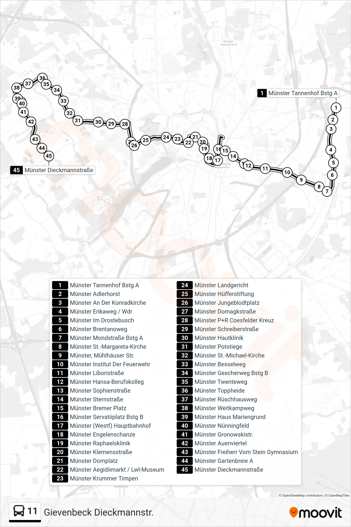
Stops list (11 - Gievenbeck Dieckmannstr.)
- Münster Tannenhof Bstg A
- Münster Adlerhorst
- Münster An Der Konradkirche
- Münster Erikaweg / Wdr
- Münster Im Drostebusch
- Münster Brentanoweg
- Münster Mondstraße Bstg A
- Münster St.-Margareta-Kirche
- Münster, Mühlhäuser Str.
- Münster Institut Der Feuerwehr
- Münster Liboristraße
- Münster Hansa-Berufskolleg
- Münster Sophienstraße
- Münster Sternstraße
- Münster Bremer Platz
- Münster Servatiiplatz Bstg B
- Münster (Westf) Hauptbahnhof
- Münster Engelenschanze
- Münster Raphaelsklinik
- Münster Klemensstraße
- Münster Domplatz
- Münster Aegidiimarkt / Lwl-Museum
- Münster Krummer Timpen
- Münster Landgericht
- Münster Hüfferstiftung
- Münster Jungeblodtplatz
- Münster Domagkstraße
- Münster P+R Coesfelder Kreuz
- Münster Schreiberstraße
- Münster Hautklinik
- Münster Potstiege
- Münster St.-Michael-Kirche
- Münster Besselweg
- Münster Gescherweg Bstg B
- Münster Twenteweg
- Münster Toppheide
- Münster Rüschhausweg
- Münster Weitkampweg
- Münster Haus Mariengrund
- Münster Nünningfeld
- Münster Gronowskistr.
- Münster Auenviertel
- Münster Freiherr Vom Stein Gymnasium
- Münster Gartenbreie A
- Münster Dieckmannstraße