
11 Bus Route Map
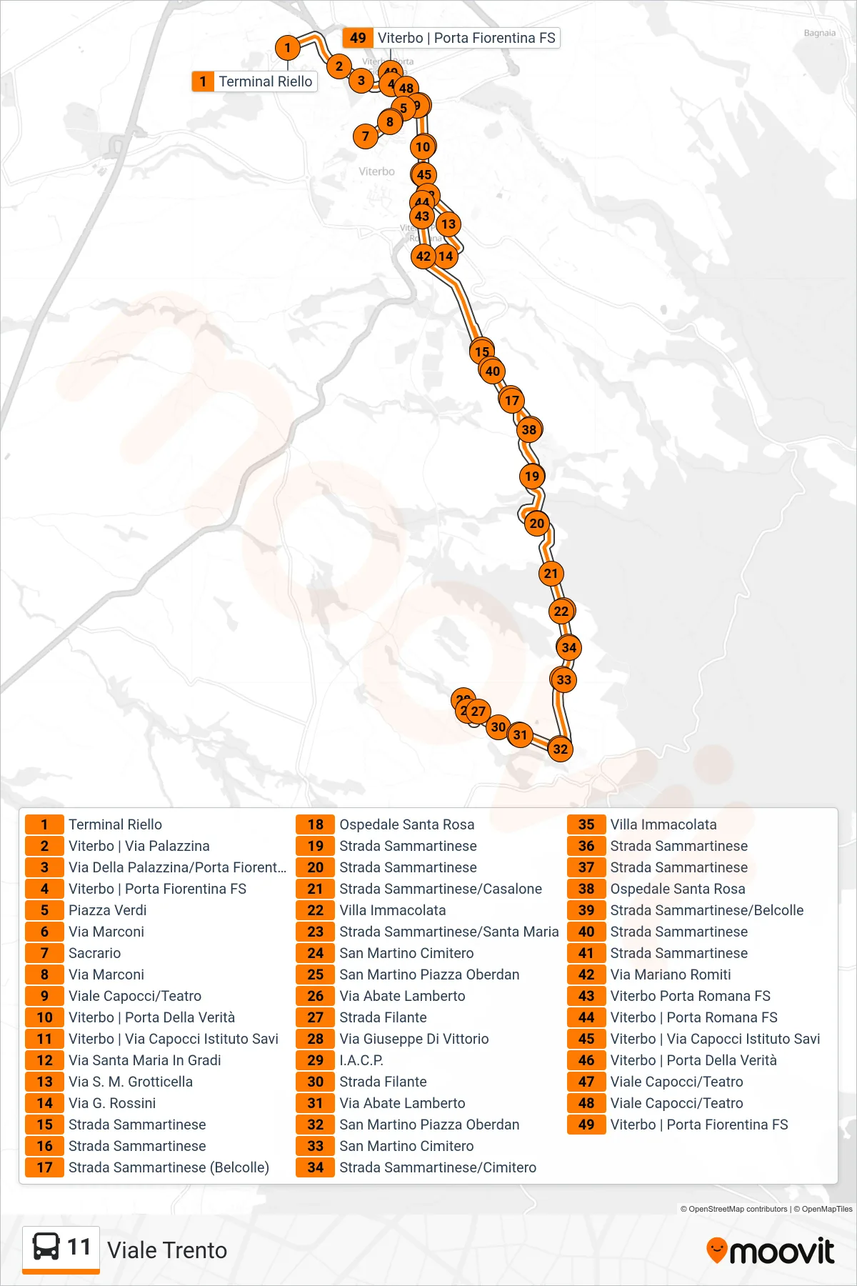
View the 11 route map and see all 11 stops along the route. The map of 11 shows where the bus travels and the location of each stop, making it easy to understand the entire route at a glance.
Explore Francigena routes on the map and see where Francigena bus services operate. Use the 11 map to find bus stops and see how the 11 connects different areas along its trip.
All 11 stops on the map are displayed in route order, helping you follow the 11 bus from the first stop to the last.
Stops list (11 - Trento Avenue)
- Riello Terminal
- Viterbo | Via Palazzina
- Palazzina Street/Florentine Gate
- Viterbo | Porta Fiorentina Station
- Verdi Square
- Marconi Street
- Shrine
- Marconi Street
- Capocci Avenue/Theater
- Viterbo | Gate of Truth
- Viterbo | Capocci Street Savi Institute
- Santa Maria In Gradi Street
- St. Mary Grotticella Road
- G. Rossini Street
- Sammartinese Road
- Sammartinese Road
- Sammartinese Road (Belcolle)
- Santa Rosa Hospital
- Sammartinese Road
- Sammartinese Road
- Sammartinese Road/Casalone
- Villa Immacolata
- Sammartinese Road/Santa Maria
- San Martino Cemetery
- San Martino Oberdan Square
- Abate Lamberto Street
- Filante Road
- Giuseppe Di Vittorio Street
- I.A.C.P.
- Filante Road
- Abate Lamberto Street
- San Martino Oberdan Square
- San Martino Cemetery
- Sammartinese Road/Cemetery
- Villa Immacolata
- Sammartinese Road
- Sammartinese Road
- Santa Rosa Hospital
- Sammartinese Road/Belcolle
- Sammartinese Road
- Sammartinese Road
- Mariano Romiti Street
- Viterbo Porta Romana Station
- Viterbo | Porta Romana Station
- Viterbo | Capocci Street Savi Institute
- Viterbo | Gate of Truth
- Capocci Avenue/Theater
- Capocci Avenue/Theater
- Viterbo | Porta Fiorentina Station