
11 Bus Route Map
View the 11 route map and see all 11 stops along the route. The map of 11 shows where the bus travels and the location of each stop, making it easy to understand the entire route at a glance.
Explore TWISTO routes on the map and see where TWISTO bus services operate. Use the 11 map to find bus stops and see how the 11 connects different areas along its trip.
All 11 stops on the map are displayed in route order, helping you follow the 11 bus from the first stop to the last.
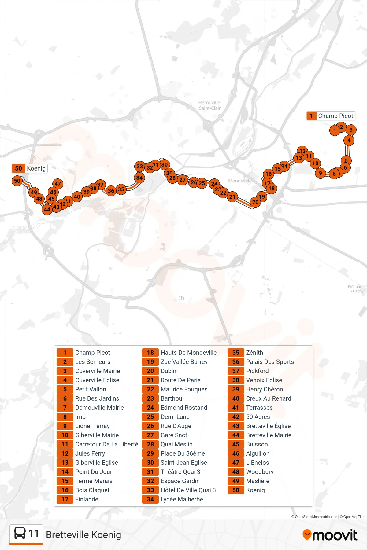
Stops list (11 - Bretteville Koenig)
- Champ Picot
- Les Semeurs
- Cuverville Mairie
- Cuverville Eglise
- Petit Vallon
- Rue Des Jardins
- Démouville Mairie
- Imp
- Lionel Terray
- Giberville Mairie
- Carrefour De La Liberté
- Jules Ferry
- Giberville Eglise
- Point Du Jour
- Ferme Marais
- Bois Claquet
- Finlande
- Hauts De Mondeville
- Zac Vallée Barrey
- Dublin
- Route De Paris
- Maurice Fouques
- Barthou
- Edmond Rostand
- Demi-Lune
- Rue D'Auge
- Gare Sncf
- Quai Meslin
- Place Du 36ème
- Saint-Jean Eglise
- Théâtre Quai 3
- Espace Gardin
- Hôtel De Ville Quai 3
- Lycée Malherbe
- Zénith
- Palais Des Sports
- Pickford
- Venoix Eglise
- Henry Chéron
- Creux Au Renard
- Terrasses
- 50 Acres
- Bretteville Église
- Bretteville Mairie
- Buisson
- Aiguillon
- L' Enclos
- Woodbury
- Maslière
- Koenig