
11 Bus Route Map
View the 11 route map and see all 11 stops along the route. The map of 11 shows where the bus travels and the location of each stop, making it easy to understand the entire route at a glance.
Explore VINE Transit routes on the map and see where VINE Transit bus services operate. Use the 11 map to find bus stops and see how the 11 connects different areas along its trip.
All 11 stops on the map are displayed in route order, helping you follow the 11 bus from the first stop to the last.
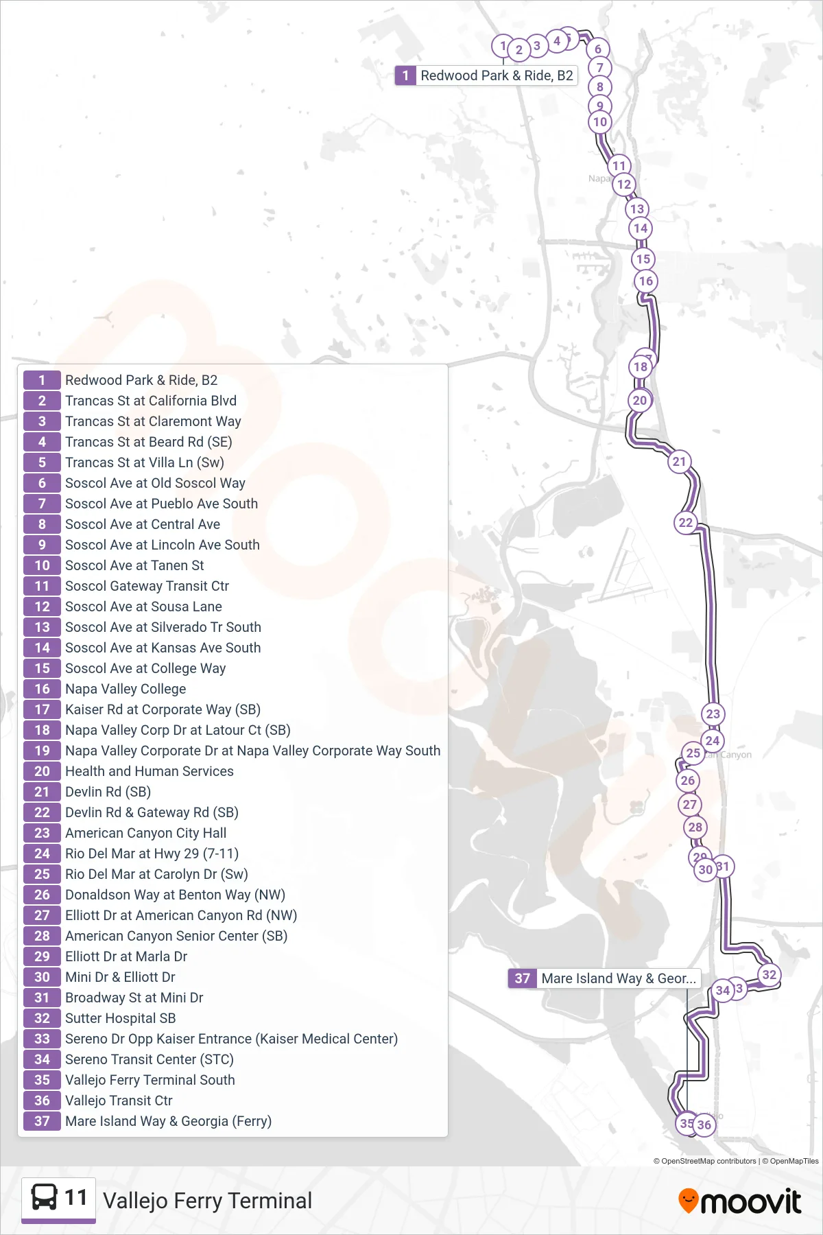
Stops list (11 - Vallejo Ferry Terminal)
- Redwood Park & Ride, B2
- Trancas St at California Blvd
- Trancas St at Claremont Way
- Trancas St at Beard Rd (SE)
- Trancas St at Villa Ln (Sw)
- Soscol Ave at Old Soscol Way
- Soscol Ave at Pueblo Ave South
- Soscol Ave at Central Ave
- Soscol Ave at Lincoln Ave South
- Soscol Ave at Tanen St
- Soscol Gateway Transit Ctr
- Soscol Ave at Sousa Lane
- Soscol Ave at Silverado Tr South
- Soscol Ave at Kansas Ave South
- Soscol Ave at College Way
- Napa Valley College
- Kaiser Rd at Corporate Way (SB)
- Napa Valley Corp Dr at Latour Ct (SB)
- Napa Valley Corporate Dr at Napa Valley Corporate Way South
- Health and Human Services
- Devlin Rd (SB)
- Devlin Rd & Gateway Rd (SB)
- American Canyon City Hall
- Rio Del Mar at Hwy 29 (7-11)
- Rio Del Mar at Carolyn Dr (Sw)
- Donaldson Way at Benton Way (NW)
- Elliott Dr at American Canyon Rd (NW)
- American Canyon Senior Center (SB)
- Elliott Dr at Marla Dr
- Mini Dr & Elliott Dr
- Broadway St at Mini Dr
- Sutter Hospital SB
- Sereno Dr Opp Kaiser Entrance (Kaiser Medical Center)
- Sereno Transit Center (STC)
- Vallejo Ferry Terminal South
- Vallejo Transit Ctr
- Mare Island Way & Georgia (Ferry)