
11 Bus Route Map
View the 11 route map and see all 11 stops along the route. The map of 11 shows where the bus travels and the location of each stop, making it easy to understand the entire route at a glance.
Explore Stadtwerke Biberach routes on the map and see where Stadtwerke Biberach bus services operate. Use the 11 map to find bus stops and see how the 11 connects different areas along its trip.
All 11 stops on the map are displayed in route order, helping you follow the 11 bus from the first stop to the last.
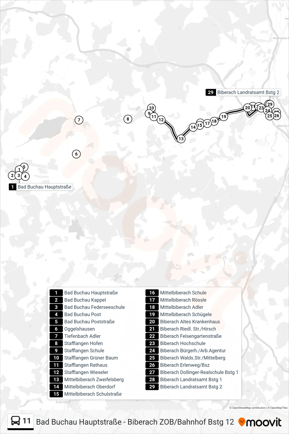
Stops list (11 - Biberach Landratsamt)
- Bad Buchau Hauptstraße
- Bad Buchau Kappel
- Bad Buchau Federseeschule
- Bad Buchau Post
- Bad Buchau Poststraße
- Oggelshausen
- Tiefenbach Adler
- Stafflangen Hofen
- Stafflangen Schule
- Stafflangen Grüner Baum
- Stafflangen Rathaus
- Stafflangen Wieseler
- Mittelbiberach Zweifelsberg
- Mittelbiberach Oberdorf
- Mittelbiberach Schulstraße
- Mittelbiberach Schule
- Mittelbiberach Rössle
- Mittelbiberach Adler
- Mittelbiberach Schügele
- Biberach Altes Krankenhaus
- Biberach Riedl. Str./Hirsch
- Biberach Felsengartenstraße
- Biberach Hochschule
- Biberach Bürgerh./Arb.Agentur
- Biberach Walds.Str./Mittelberg
- Biberach Erlenweg/Bsz
- Biberach Dollinger-Realschule Bstg 1
- Biberach Landratsamt Bstg 1
- Biberach Landratsamt Bstg 2
Change direction
- Route Map - 11 - Biberach Zob/Bahnhof
- Route Map - 11 - Stafflangen Grüner Baum
- Route Map - 11 - Mittelbiberach Schule
- Route Map - 11 - Mittelbiberach Schule
- Route Map - 11 - Bad Buchau Hauptstraße
- Route Map - 11 - Mittelbiberach Rössle
- Route Map - 11 - Bad Buchau Post
- Route Map - 11 - Stafflangen Schule
- Route Map - 11 - Biberach Holzmarkt
- Route Map - 11 - Biberach Erlenweg/Bsz