
110 Bus Route Map
View the 110 route map and see all 110 stops along the route. The map of 110 shows where the bus travels and the location of each stop, making it easy to understand the entire route at a glance.
Explore MBTA routes on the map and see where MBTA bus services operate. Use the 110 map to find bus stops and see how the 110 connects different areas along its trip.
All 110 stops on the map are displayed in route order, helping you follow the 110 bus from the first stop to the last.
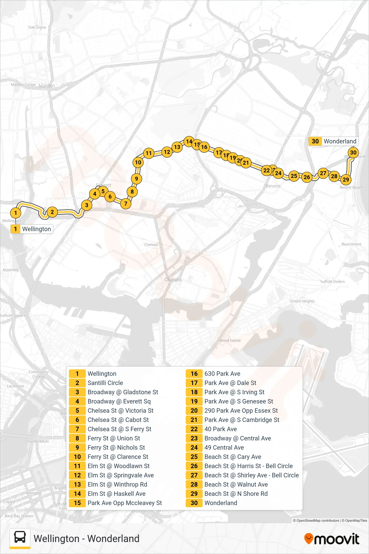
Stops list (110 - Wonderland)
- Wellington
- Santilli Circle
- Broadway @ Gladstone St
- Broadway @ Everett Sq
- Chelsea St @ Victoria St
- Chelsea St @ Cabot St
- Chelsea St @ S Ferry St
- Ferry St @ Union St
- Ferry St @ Nichols St
- Ferry St @ Clarence St
- Elm St @ Woodlawn St
- Elm St @ Springvale Ave
- Elm St @ Winthrop Rd
- Elm St @ Haskell Ave
- Park Ave Opp Mccleavey St
- 630 Park Ave
- Park Ave @ Dale St
- Park Ave @ S Irving St
- Park Ave @ S Genesee St
- 290 Park Ave Opp Essex St
- Park Ave @ S Cambridge St
- 40 Park Ave
- Broadway @ Central Ave
- 49 Central Ave
- Beach St @ Cary Ave
- Beach St @ Harris St - Bell Circle
- Beach St @ Shirley Ave - Bell Circle
- Beach St @ Walnut Ave
- Beach St @ N Shore Rd
- Wonderland