
110 Bus Route Map
View the 110 route map and see all 110 stops along the route. The map of 110 shows where the bus travels and the location of each stop, making it easy to understand the entire route at a glance.
Explore Sydtrafik routes on the map and see where Sydtrafik bus services operate. Use the 110 map to find bus stops and see how the 110 connects different areas along its trip.
All 110 stops on the map are displayed in route order, helping you follow the 110 bus from the first stop to the last.
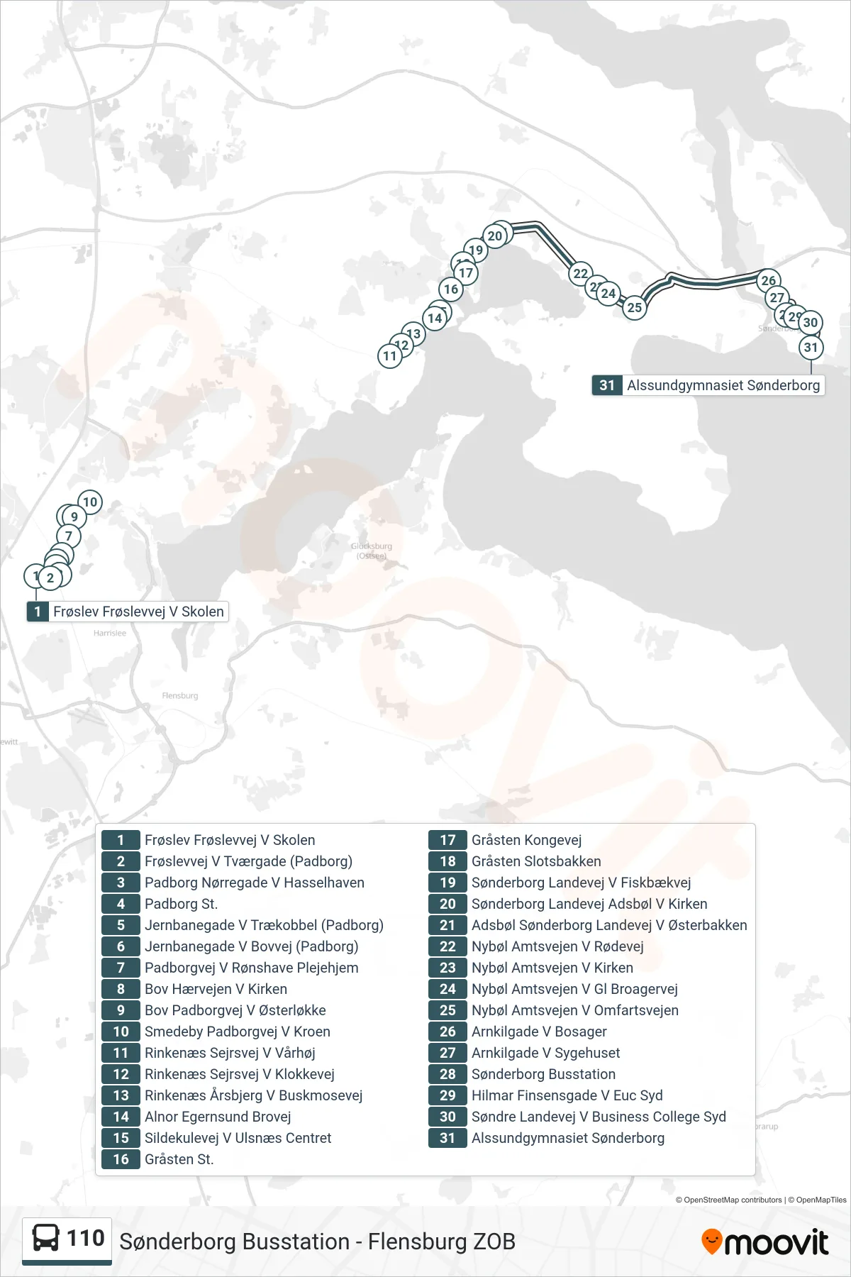
Stops list (110 - Alssundgymnasiet Sønderborg)
- Frøslev Frøslevvej V Skolen
- Frøslevvej V Tværgade (Padborg)
- Padborg Nørregade V Hasselhaven
- Padborg St.
- Jernbanegade V Trækobbel (Padborg)
- Jernbanegade V Bovvej (Padborg)
- Padborgvej V Rønshave Plejehjem
- Bov Hærvejen V Kirken
- Bov Padborgvej V Østerløkke
- Smedeby Padborgvej V Kroen
- Rinkenæs Sejrsvej V Vårhøj
- Rinkenæs Sejrsvej V Klokkevej
- Rinkenæs Årsbjerg V Buskmosevej
- Alnor Egernsund Brovej
- Sildekulevej V Ulsnæs Centret
- Gråsten St.
- Gråsten Kongevej
- Gråsten Slotsbakken
- Sønderborg Landevej V Fiskbækvej
- Sønderborg Landevej Adsbøl V Kirken
- Adsbøl Sønderborg Landevej V Østerbakken
- Nybøl Amtsvejen V Rødevej
- Nybøl Amtsvejen V Kirken
- Nybøl Amtsvejen V Gl Broagervej
- Nybøl Amtsvejen V Omfartsvejen
- Arnkilgade V Bosager
- Arnkilgade V Sygehuset
- Sønderborg Busstation
- Hilmar Finsensgade V Euc Syd
- Søndre Landevej V Business College Syd
- Alssundgymnasiet Sønderborg