
110 Bus Route Map
View the 110 route map and see all 110 stops along the route. The map of 110 shows where the bus travels and the location of each stop, making it easy to understand the entire route at a glance.
Explore Livorno and Province - Tuscan Bus Lines routes on the map and see where Livorno and Province - Tuscan Bus Lines bus services operate. Use the 110 map to find bus stops and see how the 110 connects different areas along its trip.
All 110 stops on the map are displayed in route order, helping you follow the 110 bus from the first stop to the last.
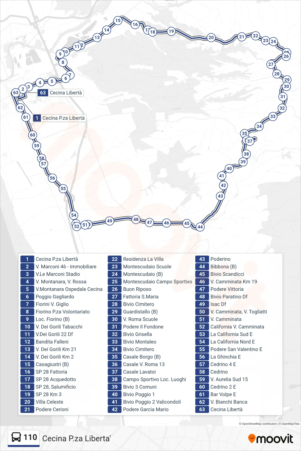
Stops list (110 - Cecina Liberty Square)
- Cecina Piazza Libertà
- 46 Marconi Street - Real Estate
- Marconi Avenue Stadium
- Montanara St, Rossa St
- Montanara St - Cecina Hospital
- Poggio Gagliardo
- Fiorini Giglio Street
- Fiorino Volunteer Square
- Fiorino Location (B)
- Via Dei Gorili Tobacco Shop
- Gorili Street #22
- Bandita Falleni
- Via Dei Gorili Km 21
- Gorili Road Km 2
- Casagiustri (B)
- SP 28 Farm
- SP 28 Aqueduct
- SP 28, Salami Factory
- SP 28 Km 3
- Celeste Villa
- Podere Cerioni
- La Villa Residence
- Montescudaio Schools
- Montescudaio (B)
- Montescudaio Sports Field
- Good Rest
- St. Maria Farm
- Cemetery Junction
- Guardistallo (B)
- Roma Street Schools
- Podere Il Fondone
- Grisella Junction
- Montaleo Junction
- Cemetery Junction
- Casale Borgo (B)
- Casale Via Roma 13
- Casale Washhouses
- Sports Field Luoghi
- Three Municipalities Junction
- Poggio Junction 1
- Poggio 2 Valicondoli Junction
- Podere Garcia Mario
- Poderino
- Bibbona (B)
- Scandicci Junction
- V. Camminata Km 19
- Vittoria Farm
- Paratino Junction
- Isac Df
- Camminata St, Togliatti St
- Camminata Street
- California Via Camminata
- La California South East
- La California North E
- San Valentino Farm E
- La Ghinchia East
- Cedrino 4 E
- Cedrino
- South Aurelia Street 15
- Cedrino 2 East
- Bar Volpe East
- Bianchi Bank Street
- Cecina Libertà