
110 Bus Route Map
View the 110 route map and see all 110 stops along the route. The map of 110 shows where the bus travels and the location of each stop, making it easy to understand the entire route at a glance.
Explore KSRTC Ordinary Bus Services routes on the map and see where KSRTC Ordinary Bus Services bus services operate. Use the 110 map to find bus stops and see how the 110 connects different areas along its trip.
All 110 stops on the map are displayed in route order, helping you follow the 110 bus from the first stop to the last.
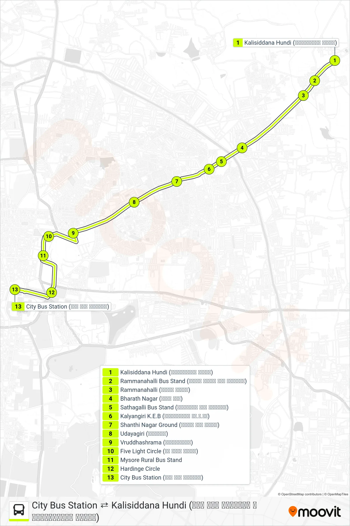
Stops list (110 - → City Bus Station (ನಗರ ಬಸ್ ನಿಲ್ದಾಣ))
- Kalisiddana Hundi (ಕಾಳಿಸಿದ್ದನ ಹುಂಡಿ)
- Rammanahalli Bus Stand (ರಮ್ಮನ ಹಳ್ಳಿ ಬಸ್ ನಿಲ್ದಾಣ)
- Rammanahalli (ರಮ್ಮನ ಹಳ್ಳಿ)
- Bharath Nagar (ಭರತ್ ನಗರ)
- Sathagalli Bus Stand (ಸಾತಗಳ್ಳಿ ಬಸ್ ನಿಲ್ದಾಣ)
- Kalyangiri K.E.B (ಕಲ್ಯಾಣಗಿರಿ ಕೆ.ಇ.ಬಿ)
- Shanthi Nagar Ground (ಶಾಂತಿ ನಗರ ಮೈದಾನ)
- Udayagiri (ಉದಯಗಿರಿ)
- Vruddhashrama (ವೃದ್ಧಾಶ್ರಮ)
- Five Light Circle (ಫೈ ಲೈಟ್ ವೃತ್ತ)
- Mysore Rural Bus Stand
- Hardinge Circle
- City Bus Station (ನಗರ ಬಸ್ ನಿಲ್ದಾಣ)