
110 Bus Route Map
View the 110 route map and see all 110 stops along the route. The map of 110 shows where the bus travels and the location of each stop, making it easy to understand the entire route at a glance.
Explore Nomad Car (Région Normandie) routes on the map and see where Nomad Car (Région Normandie) bus services operate. Use the 110 map to find bus stops and see how the 110 connects different areas along its trip.
All 110 stops on the map are displayed in route order, helping you follow the 110 bus from the first stop to the last.
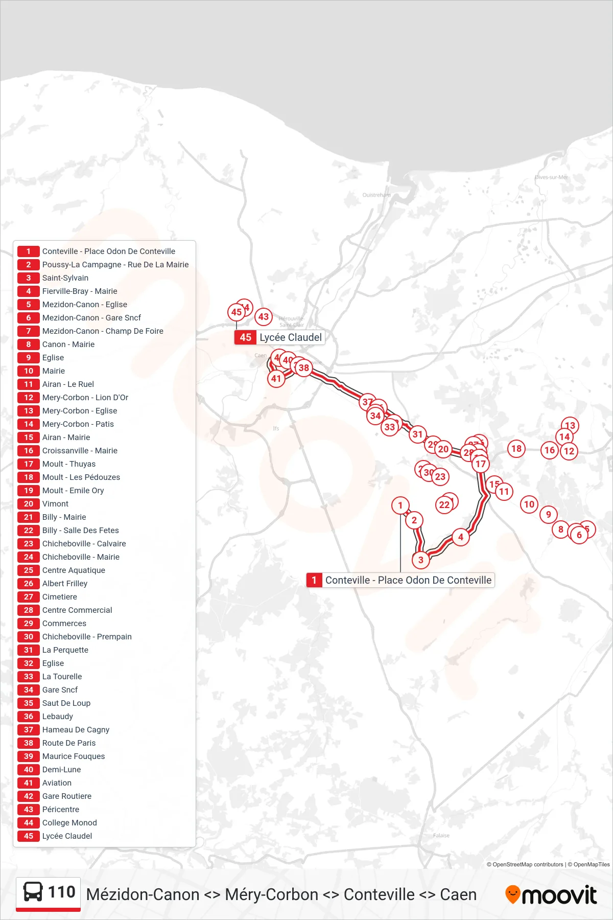

Stops list (110 - Caen)
- Mezidon-Canon - Eglise
- Mezidon-Canon - Gare Sncf
- Mezidon-Canon - Champ De Foire
- Canon - Mairie
- Eglise
- Mairie
- Conteville - Place Odon De Conteville
- Airan - Le Ruel
- Airan - Mairie
- Moult - Thuyas
- Moult - Emile Ory
- Poussy-La Campagne - Rue De La Mairie
- Saint-Sylvain
- Fierville-Bray - Mairie
- Chicheboville - Mairie
- Vimont
- Centre Aquatique
- Albert Frilley
- Cimetiere
- Centre Commercial
- Commerces
- Billy - Mairie
- Billy - Salle Des Fetes
- Chicheboville - Calvaire
- Chicheboville - Prempain
- La Perquette
- Eglise
- La Tourelle
- Gare Sncf
- Saut De Loup
- Lebaudy
- Hameau De Cagny
- Route De Paris
- Maurice Fouques
- Demi-Lune
- Aviation
- Gare Routiere
- Péricentre
- College Monod
- Lycée Claudel