
110 Bus Route Map
View the 110 route map and see all 110 stops along the route. The map of 110 shows where the bus travels and the location of each stop, making it easy to understand the entire route at a glance.
Explore SamTrans routes on the map and see where SamTrans bus services operate. Use the 110 map to find bus stops and see how the 110 connects different areas along its trip.
All 110 stops on the map are displayed in route order, helping you follow the 110 bus from the first stop to the last.
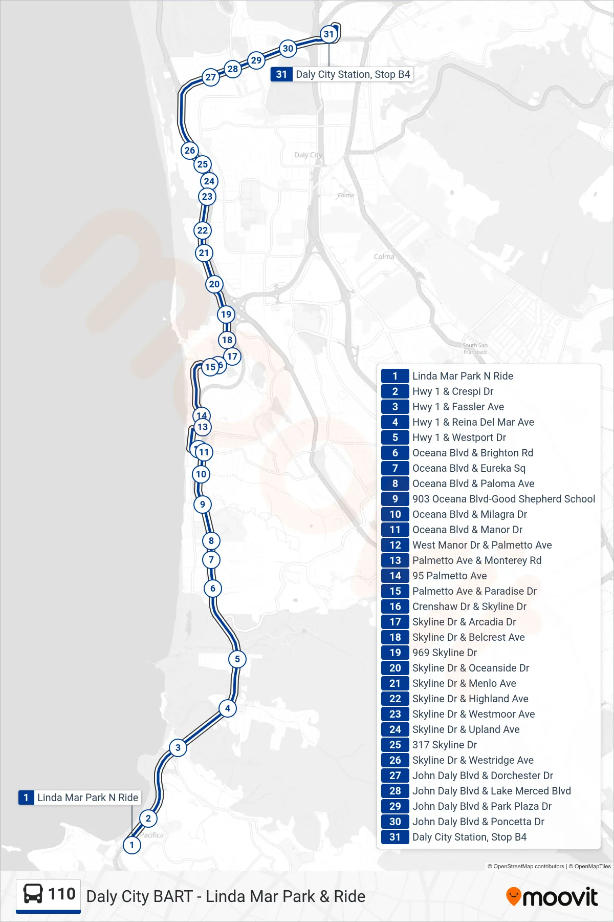
Stops list (110 - Daly City BART)
- Linda Mar Park N Ride
- Hwy 1 & Crespi Dr
- Hwy 1 & Fassler Ave
- Hwy 1 & Reina Del Mar Ave
- Hwy 1 & Westport Dr
- Oceana Blvd & Brighton Rd
- Oceana Blvd & Eureka Sq
- Oceana Blvd & Paloma Ave
- 903 Oceana Blvd-Good Shepherd School
- Oceana Blvd & Milagra Dr
- Oceana Blvd & Manor Dr
- West Manor Dr & Palmetto Ave
- Palmetto Ave & Monterey Rd
- 95 Palmetto Ave
- Palmetto Ave & Paradise Dr
- Crenshaw Dr & Skyline Dr
- Skyline Dr & Arcadia Dr
- Skyline Dr & Belcrest Ave
- 969 Skyline Dr
- Skyline Dr & Oceanside Dr
- Skyline Dr & Menlo Ave
- Skyline Dr & Highland Ave
- Skyline Dr & Westmoor Ave
- Skyline Dr & Upland Ave
- 317 Skyline Dr
- Skyline Dr & Westridge Ave
- John Daly Blvd & Dorchester Dr
- John Daly Blvd & Lake Merced Blvd
- John Daly Blvd & Park Plaza Dr
- John Daly Blvd & Poncetta Dr
- Daly City Station, Stop B4