
111 Bus Route Map
View the 111 route map and see all 111 stops along the route. The map of 111 shows where the bus travels and the location of each stop, making it easy to understand the entire route at a glance.
Explore Autobuses routes on the map and see where Autobuses bus services operate. Use the 111 map to find bus stops and see how the 111 connects different areas along its trip.
All 111 stops on the map are displayed in route order, helping you follow the 111 bus from the first stop to the last.
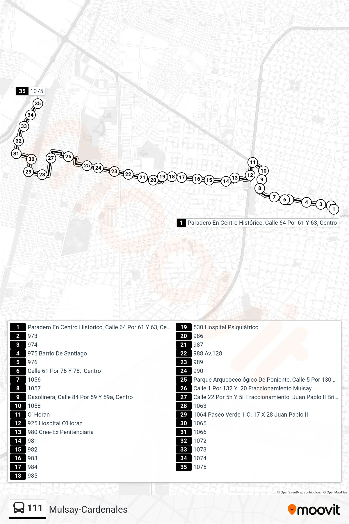
Stops list (111 - Mulsay-Cardenales)
- Paradero En Centro Histórico, Calle 64 Por 61 Y 63, Centro
- 973
- 974
- 975 Barrio De Santiago
- 976
- Calle 61 Por 76 Y 78, Centro
- 1056
- 1057
- Gasolinera, Calle 84 Por 59 Y 59a, Centro
- 1058
- O' Horan
- 925 Hospital O'Horan
- 980 Cree-Ex Penitenciaria
- 981
- 982
- 983
- 984
- 985
- 530 Hospital Psiquiátrico
- 986
- 987
- 988 Av.128
- 989
- 990
- Parque Arqueoecológico De Poniente, Calle 5 Por 130 Y 14a, Fraccionamiento Mulsay
- Calle 1 Por 132 Y 20 Fraccionamiento Mulsay
- Calle 22 Por 5h Y 5i, Fraccionamiento Juan Pablo II Brisas De Poniente
- 1063
- 1064 Paseo Verde 1 C. 17 X 28 Juan Pablo II
- 1065
- 1066
- 1072
- 1073
- 1074
- 1075