
111 Bus Route Map
View the 111 route map and see all 111 stops along the route. The map of 111 shows where the bus travels and the location of each stop, making it easy to understand the entire route at a glance.
Explore Nomad Car (Région Normandie) routes on the map and see where Nomad Car (Région Normandie) bus services operate. Use the 111 map to find bus stops and see how the 111 connects different areas along its trip.
All 111 stops on the map are displayed in route order, helping you follow the 111 bus from the first stop to the last.
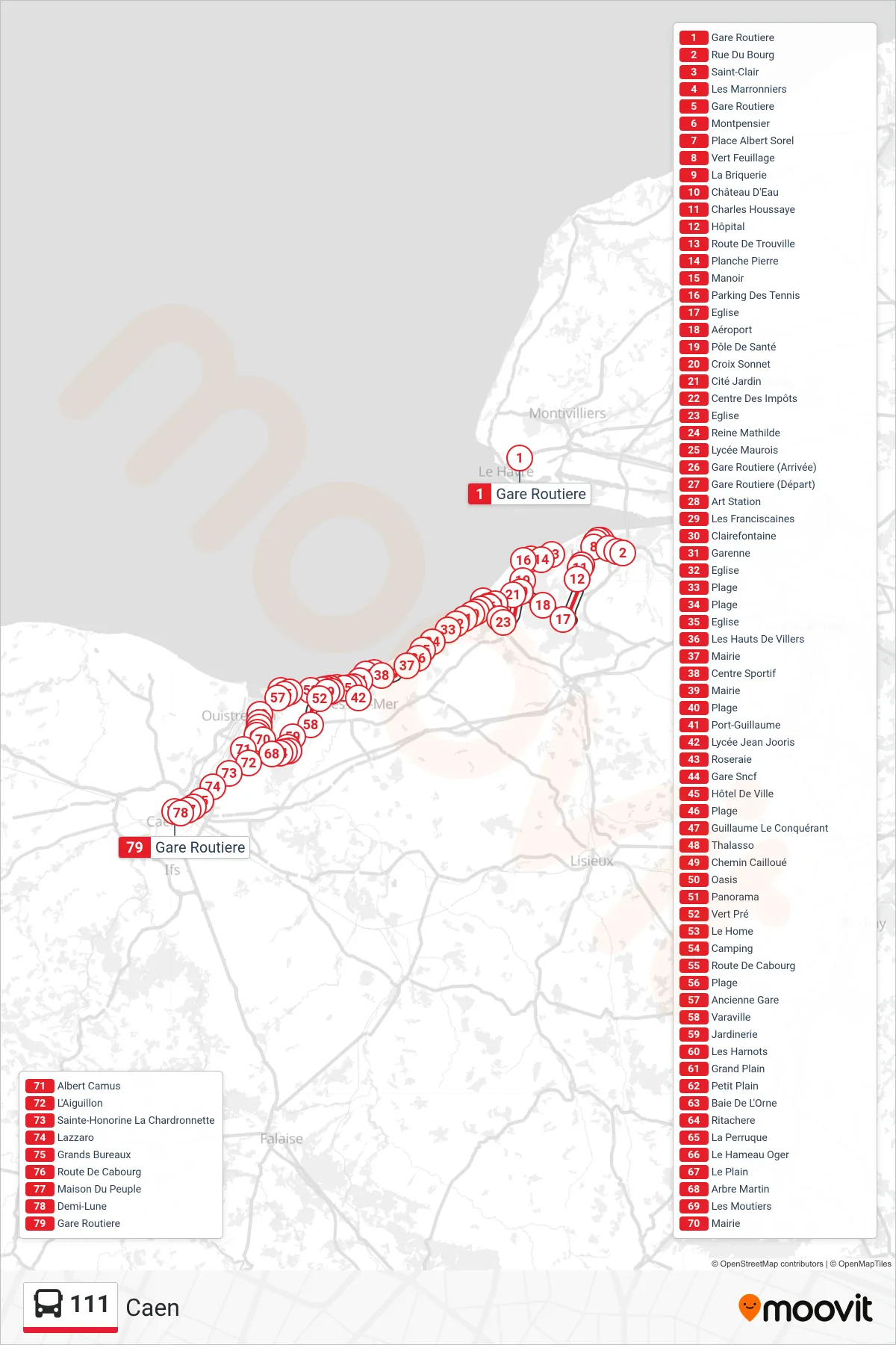
Stops list (111 - Caen)
- Gare Routiere
- Rue Du Bourg
- Saint-Clair
- Les Marronniers
- Gare Routiere
- Montpensier
- Place Albert Sorel
- Vert Feuillage
- La Briquerie
- Château D'Eau
- Charles Houssaye
- Hôpital
- Route De Trouville
- Planche Pierre
- Manoir
- Parking Des Tennis
- Eglise
- Aéroport
- Pôle De Santé
- Croix Sonnet
- Cité Jardin
- Centre Des Impôts
- Eglise
- Reine Mathilde
- Lycée Maurois
- Gare Routiere (Arrivée)
- Gare Routiere (Départ)
- Art Station
- Les Franciscaines
- Clairefontaine
- Garenne
- Eglise
- Plage
- Plage
- Eglise
- Les Hauts De Villers
- Mairie
- Centre Sportif
- Mairie
- Plage
- Port-Guillaume
- Lycée Jean Jooris
- Roseraie
- Gare Sncf
- Hôtel De Ville
- Plage
- Guillaume Le Conquérant
- Thalasso
- Chemin Cailloué
- Oasis
- Panorama
- Vert Pré
- Le Home
- Camping
- Route De Cabourg
- Plage
- Ancienne Gare
- Varaville
- Jardinerie
- Les Harnots
- Grand Plain
- Petit Plain
- Baie De L'Orne
- Ritachere
- La Perruque
- Le Hameau Oger
- Le Plain
- Arbre Martin
- Les Moutiers
- Mairie
- Albert Camus
- L'Aiguillon
- Sainte-Honorine La Chardronnette
- Lazzaro
- Grands Bureaux
- Route De Cabourg
- Maison Du Peuple
- Demi-Lune
- Gare Routiere