
111 Bus Route Map
View the 111 route map and see all 111 stops along the route. The map of 111 shows where the bus travels and the location of each stop, making it easy to understand the entire route at a glance.
Explore Hampton Roads Transit (HRT) routes on the map and see where Hampton Roads Transit (HRT) bus services operate. Use the 111 map to find bus stops and see how the 111 connects different areas along its trip.
All 111 stops on the map are displayed in route order, helping you follow the 111 bus from the first stop to the last.
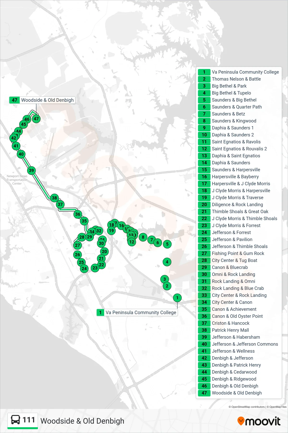
Stops list (111 - Woodside & Old Denbigh)
- Va Peninsula Community College
- Thomas Nelson & Battle
- Big Bethel & Park
- Big Bethel & Tupelo
- Saunders & Big Bethel
- Saunders & Quarter Path
- Saunders & Betz
- Saunders & Kingwood
- Daphia & Saunders 1
- Daphia & Saunders 2
- Saint Egnatios & Ravolis
- Saint Egnatios & Rouvalis 2
- Daphia & Saint Egnatios
- Daphia & Saunders
- Saunders & Harpersville
- Harpersville & Bayberry
- Harpersville & J Clyde Morris
- J Clyde Morris & Harpersville
- J Clyde Morris & Traverse
- Diligence & Rock Landing
- Thimble Shoals & Great Oak
- J Clyde Morris & Thimble Shoals
- J Clyde Morris & Forrest
- Jefferson & Forrest
- Jefferson & Pavilion
- Jefferson & Thimble Shoals
- Fishing Point & Gum Rock
- City Center & Tug Boat
- Canon & Bluecrab
- Omni & Rock Landing
- Rock Landing & Omni
- Rock Landing & Blue Crab
- City Center & Rock Landing
- City Center & Canon
- Canon & Achievement
- Canon & Old Oyster Point
- Criston & Hancock
- Patrick Henry Mall
- Jefferson & Habersham
- Jefferson & Jefferson Commons
- Jefferson & Wellness
- Denbigh & Jefferson
- Denbigh & Patrick Henry
- Denbigh & Cedarwood
- Denbigh & Ridgewood
- Denbigh & Old Denbigh
- Woodside & Old Denbigh