
112 Bus Route Map
View the 112 route map and see all 112 stops along the route. The map of 112 shows where the bus travels and the location of each stop, making it easy to understand the entire route at a glance.
Explore Regional Transportation District routes on the map and see where Regional Transportation District bus services operate. Use the 112 map to find bus stops and see how the 112 connects different areas along its trip.
All 112 stops on the map are displayed in route order, helping you follow the 112 bus from the first stop to the last.
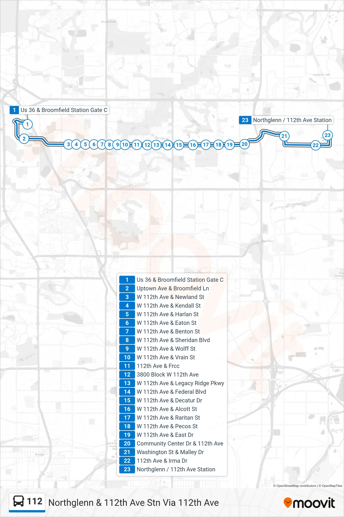
Stops list (112 - Northglenn & 112th Ave Stn Via 112th Ave)
- Us 36 & Broomfield Station Gate C
- Uptown Ave & Broomfield Ln
- W 112th Ave & Newland St
- W 112th Ave & Kendall St
- W 112th Ave & Harlan St
- W 112th Ave & Eaton St
- W 112th Ave & Benton St
- W 112th Ave & Sheridan Blvd
- W 112th Ave & Wolff St
- W 112th Ave & Vrain St
- 112th Ave & Frcc
- 3800 Block W 112th Ave
- W 112th Ave & Legacy Ridge Pkwy
- W 112th Ave & Federal Blvd
- W 112th Ave & Decatur Dr
- W 112th Ave & Alcott St
- W 112th Ave & Raritan St
- W 112th Ave & Pecos St
- W 112th Ave & East Dr
- Community Center Dr & 112th Ave
- Washington St & Malley Dr
- 112th Ave & Irma Dr
- Northglenn / 112th Ave Station