
112 Bus Route Map
View the 112 route map and see all 112 stops along the route. The map of 112 shows where the bus travels and the location of each stop, making it easy to understand the entire route at a glance.
Explore TCL SYTRAL routes on the map and see where TCL SYTRAL bus services operate. Use the 112 map to find bus stops and see how the 112 connects different areas along its trip.
All 112 stops on the map are displayed in route order, helping you follow the 112 bus from the first stop to the last.
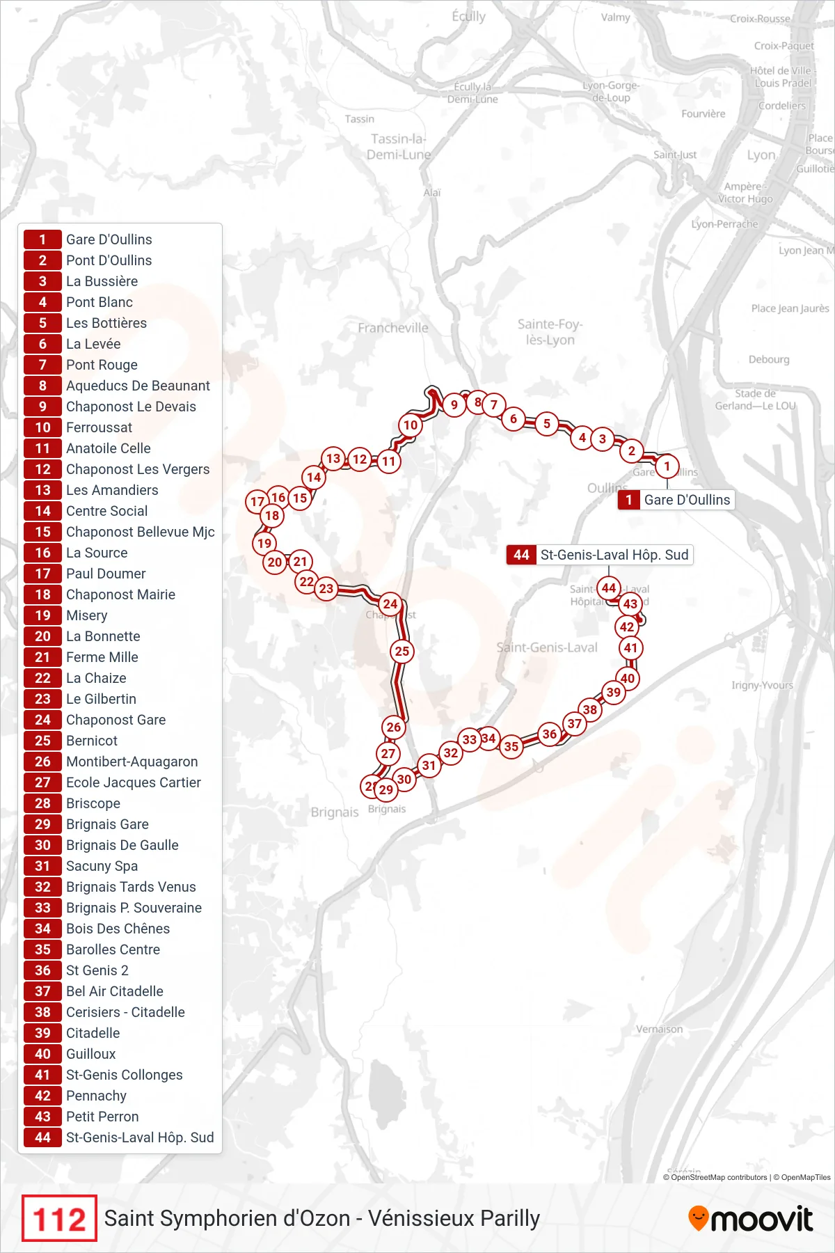
Stops list (112 - St-Genis-Laval Hôp. Sud)
- Gare D'Oullins
- Pont D'Oullins
- La Bussière
- Pont Blanc
- Les Bottières
- La Levée
- Pont Rouge
- Aqueducs De Beaunant
- Chaponost Le Devais
- Ferroussat
- Anatoile Celle
- Chaponost Les Vergers
- Les Amandiers
- Centre Social
- Chaponost Bellevue Mjc
- La Source
- Paul Doumer
- Chaponost Mairie
- Misery
- La Bonnette
- Ferme Mille
- La Chaize
- Le Gilbertin
- Chaponost Gare
- Bernicot
- Montibert-Aquagaron
- Ecole Jacques Cartier
- Briscope
- Brignais Gare
- Brignais De Gaulle
- Sacuny Spa
- Brignais Tards Venus
- Brignais P. Souveraine
- Bois Des Chênes
- Barolles Centre
- St Genis 2
- Bel Air Citadelle
- Cerisiers - Citadelle
- Citadelle
- Guilloux
- St-Genis Collonges
- Pennachy
- Petit Perron
- St-Genis-Laval Hôp. Sud