
112 Bus Route Map
View the 112 route map and see all 112 stops along the route. The map of 112 shows where the bus travels and the location of each stop, making it easy to understand the entire route at a glance.
Explore Verkehrsbetrieb Rhein-Westerwald GmbH routes on the map and see where Verkehrsbetrieb Rhein-Westerwald GmbH bus services operate. Use the 112 map to find bus stops and see how the 112 connects different areas along its trip.
All 112 stops on the map are displayed in route order, helping you follow the 112 bus from the first stop to the last.
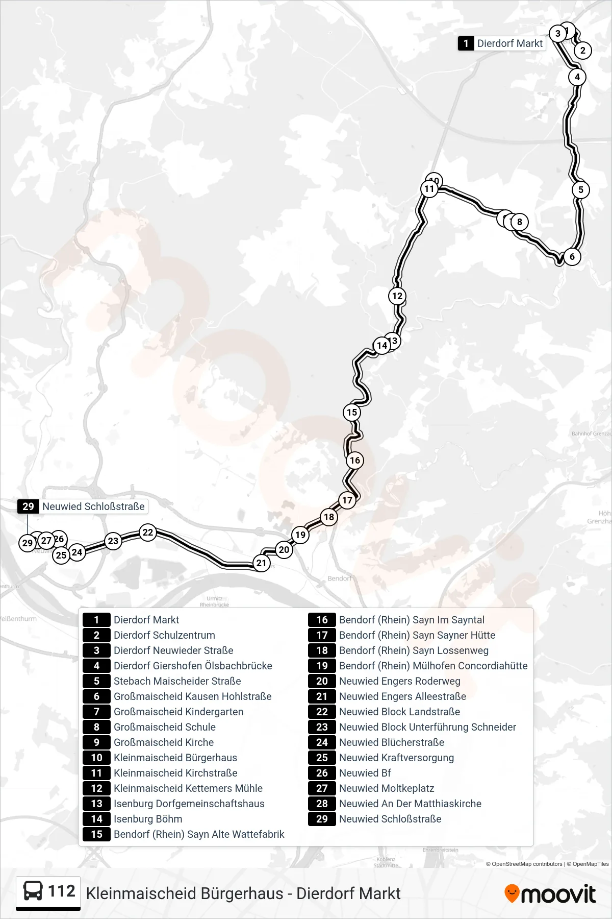
Stops list (112 - Neuwied Schloßstraße)
- Dierdorf Markt
- Dierdorf Schulzentrum
- Dierdorf Neuwieder Straße
- Dierdorf Giershofen Ölsbachbrücke
- Stebach Maischeider Straße
- Großmaischeid Kausen Hohlstraße
- Großmaischeid Kindergarten
- Großmaischeid Schule
- Großmaischeid Kirche
- Kleinmaischeid Bürgerhaus
- Kleinmaischeid Kirchstraße
- Kleinmaischeid Kettemers Mühle
- Isenburg Dorfgemeinschaftshaus
- Isenburg Böhm
- Bendorf (Rhein) Sayn Alte Wattefabrik
- Bendorf (Rhein) Sayn Im Sayntal
- Bendorf (Rhein) Sayn Sayner Hütte
- Bendorf (Rhein) Sayn Lossenweg
- Bendorf (Rhein) Mülhofen Concordiahütte
- Neuwied Engers Roderweg
- Neuwied Engers Alleestraße
- Neuwied Block Landstraße
- Neuwied Block Unterführung Schneider
- Neuwied Blücherstraße
- Neuwied Kraftversorgung
- Neuwied Bf
- Neuwied Moltkeplatz
- Neuwied An Der Matthiaskirche
- Neuwied Schloßstraße
Change direction
- Route Map - 112 - Neuwied Bf
- Route Map - 112 - Dierdorf Sz-Center
- Route Map - 112 - Kleinmaischeid Bürgerhaus
- Route Map - 112 - Puderbach Schulzentrum
- Route Map - 112 - Großmaischeid Kirche
- Route Map - 112 - Vallendar Schönstatt
- Route Map - 112 - Dierdorf Schulzentrum
- Route Map - 112 - Großmaischeid Schule
- Route Map - 112 - Dierdorf Markt
- Route Map - 112 - Isenburg Dorfgemeinschaftshaus