
113 Bus Route Map
View the 113 route map and see all 113 stops along the route. The map of 113 shows where the bus travels and the location of each stop, making it easy to understand the entire route at a glance.
Explore SWEG Südwestdeutsche Landesverkehrs-GmbH routes on the map and see where SWEG Südwestdeutsche Landesverkehrs-GmbH bus services operate. Use the 113 map to find bus stops and see how the 113 connects different areas along its trip.
All 113 stops on the map are displayed in route order, helping you follow the 113 bus from the first stop to the last.
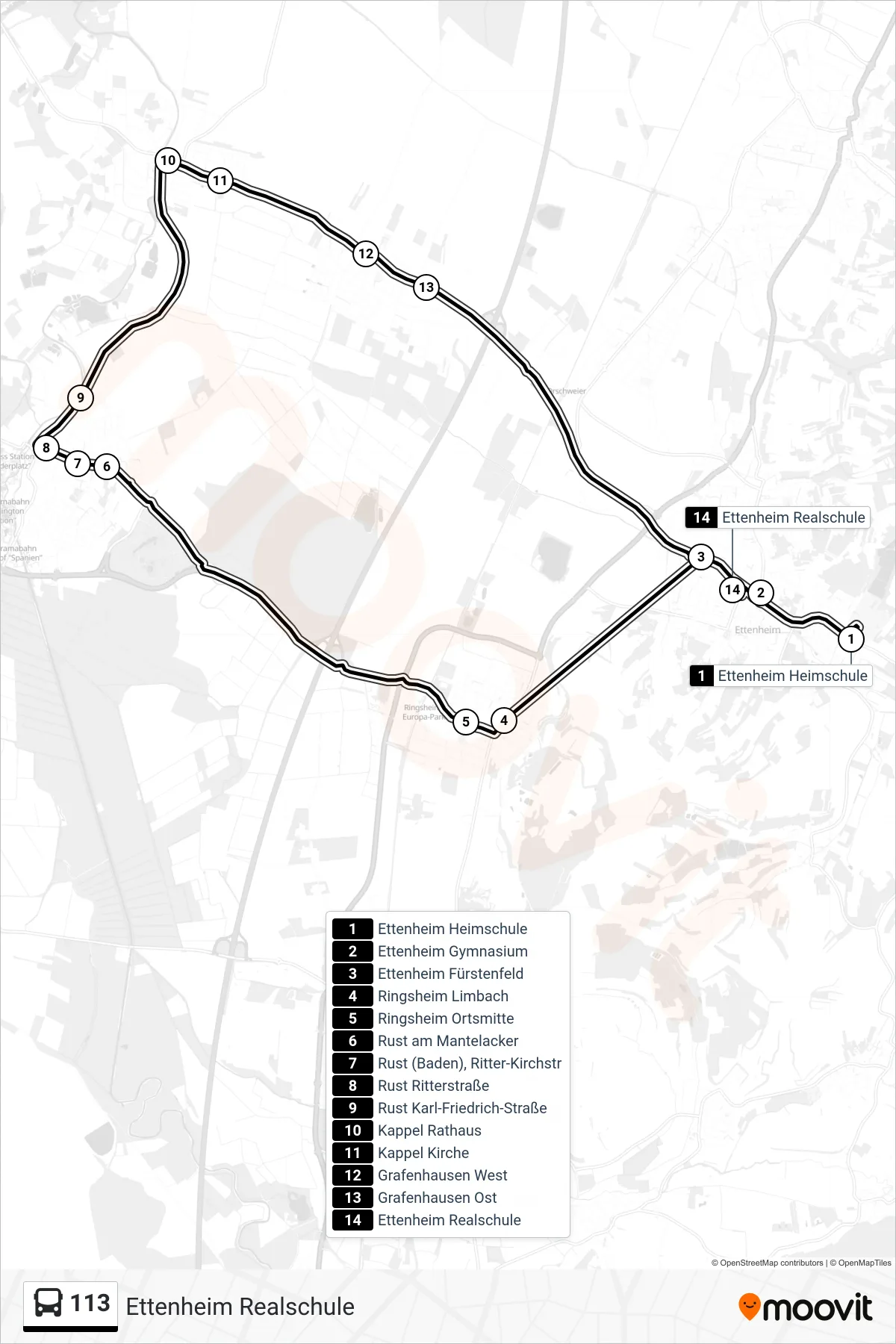
Stops list (113 - Ettenheim Realschule)
- Ettenheim Heimschule
- Ettenheim Gymnasium
- Ettenheim Fürstenfeld
- Ringsheim Limbach
- Ringsheim Ortsmitte
- Rust am Mantelacker
- Rust (Baden), Ritter-Kirchstr
- Rust Ritterstraße
- Rust Karl-Friedrich-Straße
- Kappel Rathaus
- Kappel Kirche
- Grafenhausen West
- Grafenhausen Ost
- Ettenheim Realschule
Change direction
- Route Map - 113 - Lahr Schlüssel
- Route Map - 113 - Rust Ritterstraße
- Route Map - 113 - Rust Rathaus
- Route Map - 113 - Ettenheim Gymnasium
- Route Map - 113 - Kippenheim Bahnhofstraße
- Route Map - 113 - Lahr Bergstraße/Stadtp.
- Route Map - 113 - Orschweier
- Route Map - 113 - Ringsheim Limbach
- Route Map - 113 - Lahr Lotzbeck-Apotheke
- Route Map - 113 - Lahr Gutenbergstraße
- Route Map - 113 - Ettenheim Fürstenfeld
- Route Map - 113 - Rust Karl-Friedrich-Straße
- Route Map - 113 - Kippenheim Schule
- Route Map - 113 - Lahr West
- Route Map - 113 - Ettenheim Gymnasium
- Route Map - 113 - Orschweier
- Route Map - 113 - Kappel Rathaus
- Route Map - 113 - Ettenheim Heimschule
- Route Map - 113 - Rust Schule