
114 Bus Route Map
View the 114 route map and see all 114 stops along the route. The map of 114 shows where the bus travels and the location of each stop, making it easy to understand the entire route at a glance.
Explore KP Kyivpastrans routes on the map and see where KP Kyivpastrans bus services operate. Use the 114 map to find bus stops and see how the 114 connects different areas along its trip.
All 114 stops on the map are displayed in route order, helping you follow the 114 bus from the first stop to the last.
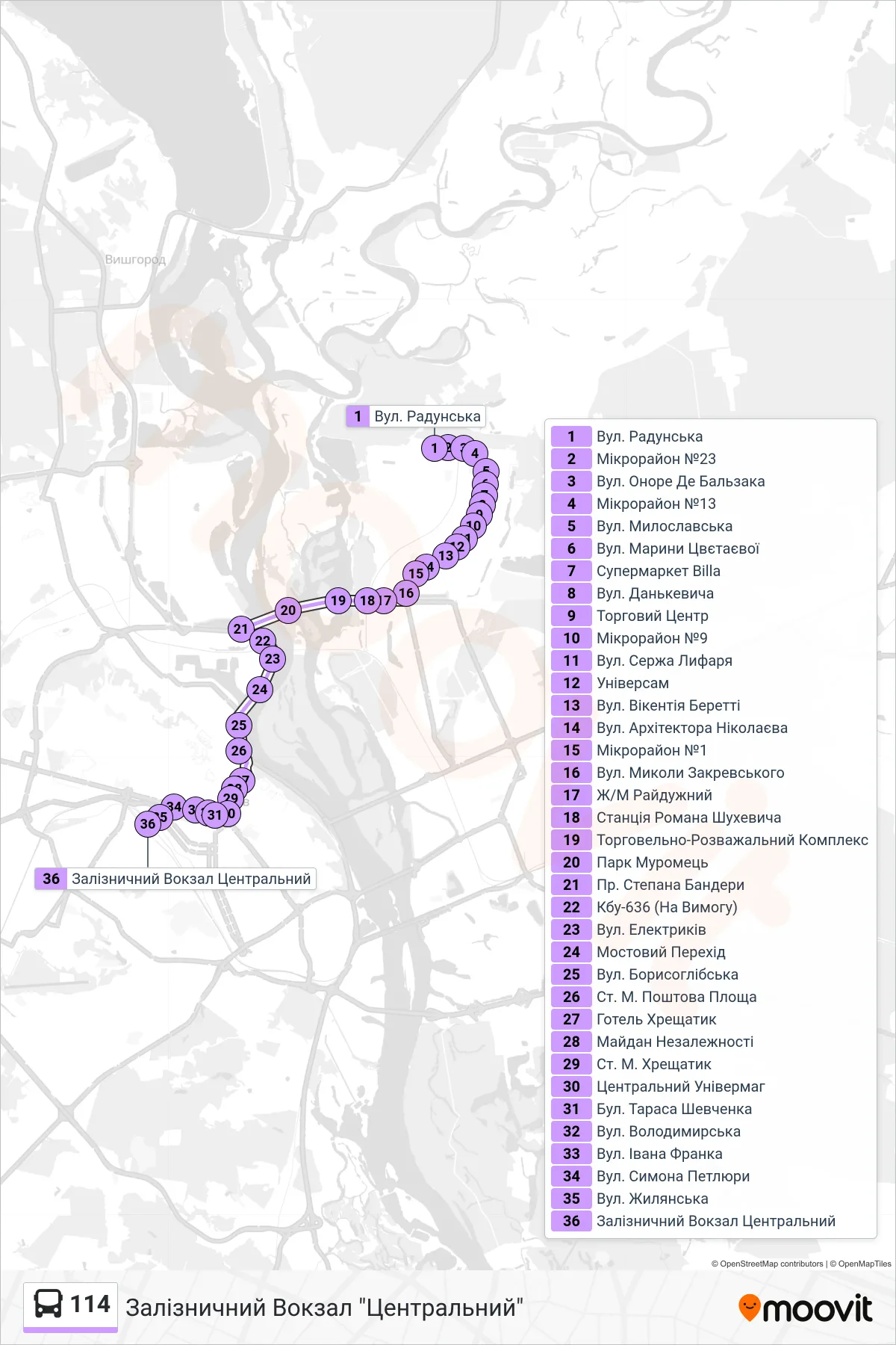
Stops list (114 - Central Railway Station)
- Radunska Street
- Microdistrict 23
- Honore de Balzac Street
- Microdistrict 13
- Myloslavska St.
- Maryna Tsvetaeva Street
- Billa Supermarket
- Dankevycha St
- Shopping Center
- Microdistrict 9
- Serzha Lyfaria Street
- Universam
- Vikentiia Beretti St
- Architect Nikolaev Street
- Microdistrict 1
- Mykoly Zakrevskoho Street
- Raiduzhny District
- Roman Shukhevych Station
- Shopping and Entertainment Complex
- Muromets Park
- Stepana Bandery Ave
- KBU-636 (On Request)
- Elektrykiv Street
- Bridge Crossing
- Borysohlebska Street
- Poshtova Square Metro Station
- Khreshchatyk Hotel
- Independence Square
- Khreshchatyk Metro Station
- Central Department Store
- Taras Shevchenko Blvd
- Volodymyrska St
- Ivan Franko St
- Symon Petliura Street
- Zhylianska St
- Central Railway Station