
115 Bus Route Map
View the 115 route map and see all 115 stops along the route. The map of 115 shows where the bus travels and the location of each stop, making it easy to understand the entire route at a glance.
Explore ATAC routes on the map and see where ATAC bus services operate. Use the 115 map to find bus stops and see how the 115 connects different areas along its trip.
All 115 stops on the map are displayed in route order, helping you follow the 115 bus from the first stop to the last.
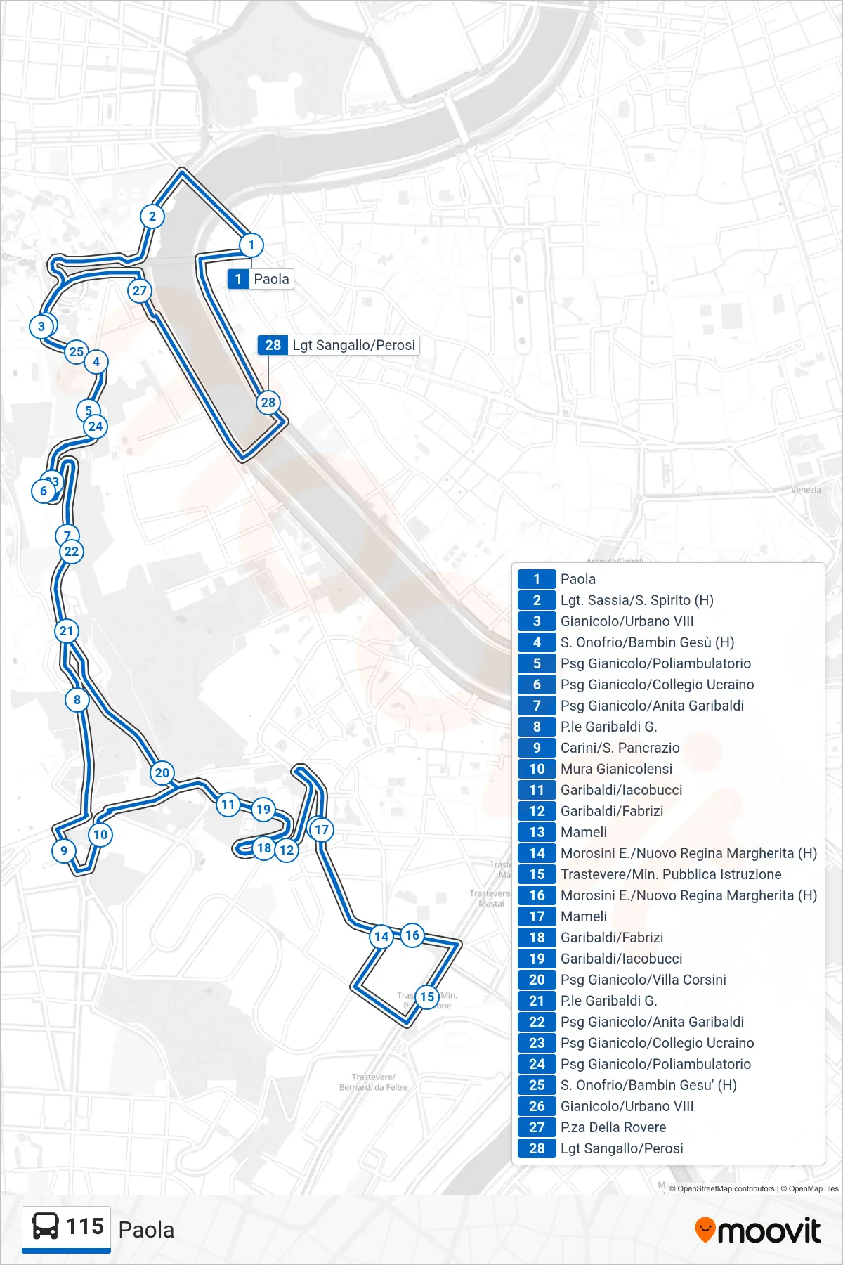
Stops list (115 - Paola)
- Paola
- Lungotevere Sassia/Santo Spirito (H)
- Gianicolo/Urban VIII
- St. Onofrio/Baby Jesus Hospital
- Gianicolo Pass/Medical Center
- Gianicolo Pass/Ukrainian College
- Gianicolo/Anita Garibaldi Stop
- Garibaldi Square G.
- Carini/St. Pancrazio
- Janiculum Walls
- Garibaldi/Iacobucci
- Garibaldi/Fabrizi
- Mameli
- Morosini E./New Regina Margherita (Hospital)
- Trastevere/Ministry of Public Education
- Morosini E./New Regina Margherita (Hospital)
- Mameli
- Garibaldi/Fabrizi
- Garibaldi/Iacobucci
- Gianicolo Passage/Villa Corsini
- Garibaldi Square G.
- Gianicolo/Anita Garibaldi Stop
- Gianicolo Pass/Ukrainian College
- Gianicolo Pass/Medical Center
- St. Onofrio/Bambino Gesu Hospital
- Gianicolo/Urban VIII
- Piazza Della Rovere
- Sangallo/Perosi Light Rail