
1154 Bus Route Map
View the 1154 route map and see all 1154 stops along the route. The map of 1154 shows where the bus travels and the location of each stop, making it easy to understand the entire route at a glance.
Explore Haßberge routes on the map and see where Haßberge bus services operate. Use the 1154 map to find bus stops and see how the 1154 connects different areas along its trip.
All 1154 stops on the map are displayed in route order, helping you follow the 1154 bus from the first stop to the last.
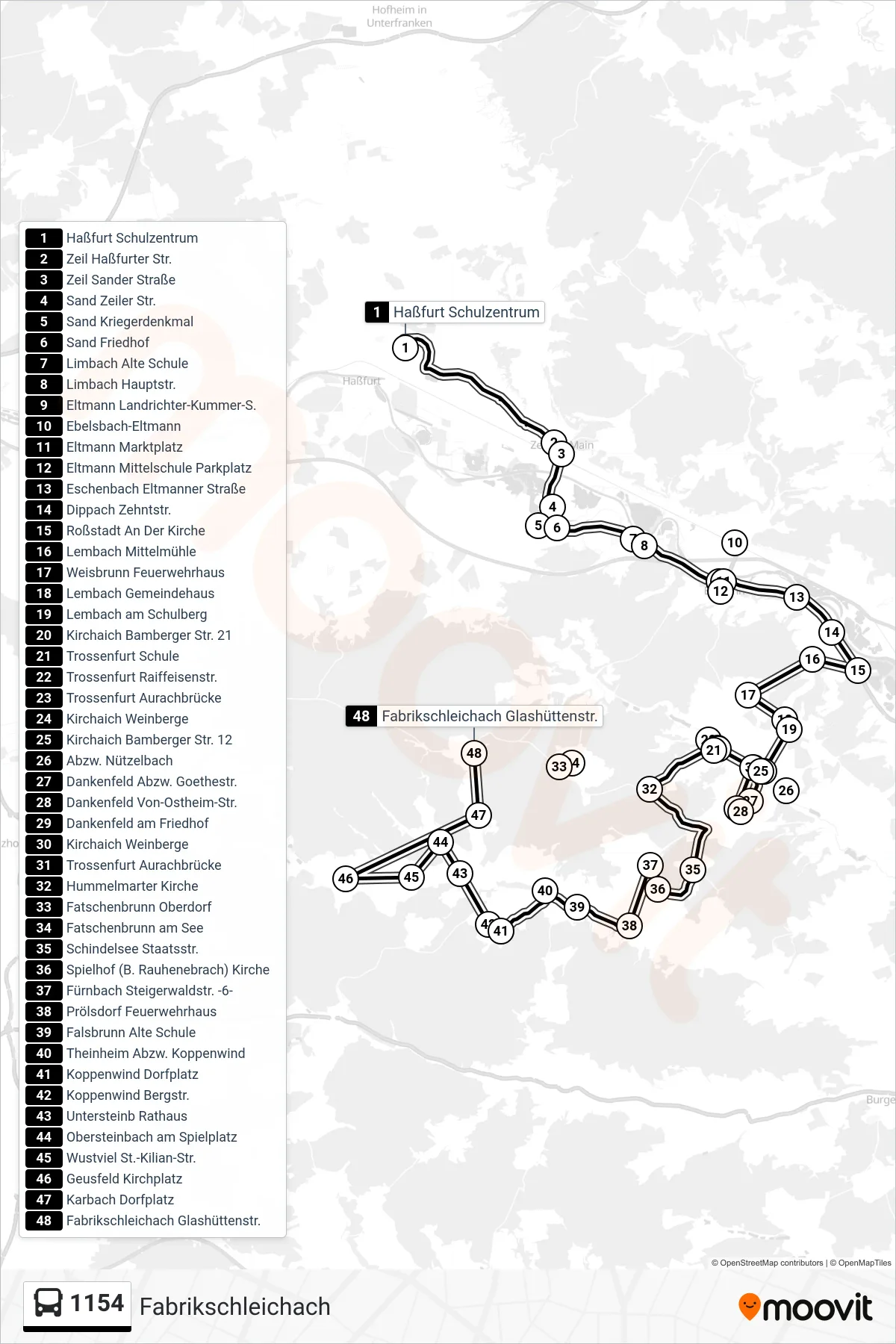
Stops list (1154 - Fabrikschleichach)
- Haßfurt Schulzentrum
- Zeil Haßfurter Str.
- Zeil Sander Straße
- Sand Zeiler Str.
- Sand Kriegerdenkmal
- Sand Friedhof
- Limbach Alte Schule
- Limbach Hauptstr.
- Eltmann Landrichter-Kummer-S.
- Ebelsbach-Eltmann
- Eltmann Marktplatz
- Eltmann Mittelschule Parkplatz
- Eschenbach Eltmanner Straße
- Dippach Zehntstr.
- Roßstadt An Der Kirche
- Lembach Mittelmühle
- Weisbrunn Feuerwehrhaus
- Lembach Gemeindehaus
- Lembach am Schulberg
- Kirchaich Bamberger Str. 21
- Trossenfurt Schule
- Trossenfurt Raiffeisenstr.
- Trossenfurt Aurachbrücke
- Kirchaich Weinberge
- Kirchaich Bamberger Str. 12
- Abzw. Nützelbach
- Dankenfeld Abzw. Goethestr.
- Dankenfeld Von-Ostheim-Str.
- Dankenfeld am Friedhof
- Kirchaich Weinberge
- Trossenfurt Aurachbrücke
- Hummelmarter Kirche
- Fatschenbrunn Oberdorf
- Fatschenbrunn am See
- Schindelsee Staatsstr.
- Spielhof (B. Rauhenebrach) Kirche
- Fürnbach Steigerwaldstr. -6-
- Prölsdorf Feuerwehrhaus
- Falsbrunn Alte Schule
- Theinheim Abzw. Koppenwind
- Koppenwind Dorfplatz
- Koppenwind Bergstr.
- Untersteinb Rathaus
- Obersteinbach am Spielplatz
- Wustviel St.-Kilian-Str.
- Geusfeld Kirchplatz
- Karbach Dorfplatz
- Fabrikschleichach Glashüttenstr.
Change direction
- Route Map - 1154 - Sand A. Main (1) Zeil Via 1175
- Route Map - 1154 - Oberaurach Abzw. Nützelbach
- Route Map - 1154 - Eltmann Grundschule
- Route Map - 1154 - Ebelsbach Bahnhof
- Route Map - 1154 - Falsbrunn
- Route Map - 1154 - Geusfeld
- Route Map - 1154 - Haßfurt Bahnhof Üb. Schulzentr.
- Route Map - 1154 - Neuschleichach
- Route Map - 1154 - Haßfurt Bahnhof
- Route Map - 1154 - Weisbrunn
- Route Map - 1154 - Koppenwind
- Route Map - 1154 - Haßfurt Schulzentrum
- Route Map - 1154 - Eltmann Marktplatz
- Route Map - 1154 - Knetzgau Turngarten
- Route Map - 1154 - Tretzendorf Üb Fatschenbrunn
- Route Map - 1154 - Geusfeld (4)
- Route Map - 1154 - Eltmann Mittelschule
- Route Map - 1154 - Eltmann Mittelschule
- Route Map - 1154 - Koppenwind Üb Trossenfurt (2)
- Route Map - 1154 - Hummelmarter
- Route Map - 1154 - Ebelsbach Bahnhof
- Route Map - 1154 - Trossenfurt Schule
- Route Map - 1154 - Sand A. Main Kriegerdenkmal
- Route Map - 1154 - Knetzgau
- Route Map - 1154 - Dankenfeld
- Route Map - 1154 - Unterschleichach
- Route Map - 1154 - Zeil A. Main
- Route Map - 1154 - Kirchaich Üb. Lembach (3)
- Route Map - 1154 - Trossenfurt Schule
- Route Map - 1154 - Sand A. Main
- Route Map - 1154 - Tretzendorf