
116 Bus Route Map
View the 116 route map and see all 116 stops along the route. The map of 116 shows where the bus travels and the location of each stop, making it easy to understand the entire route at a glance.
Explore Bus Átha Cliath – Dublin Bus routes on the map and see where Bus Átha Cliath – Dublin Bus bus services operate. Use the 116 map to find bus stops and see how the 116 connects different areas along its trip.
All 116 stops on the map are displayed in route order, helping you follow the 116 bus from the first stop to the last.
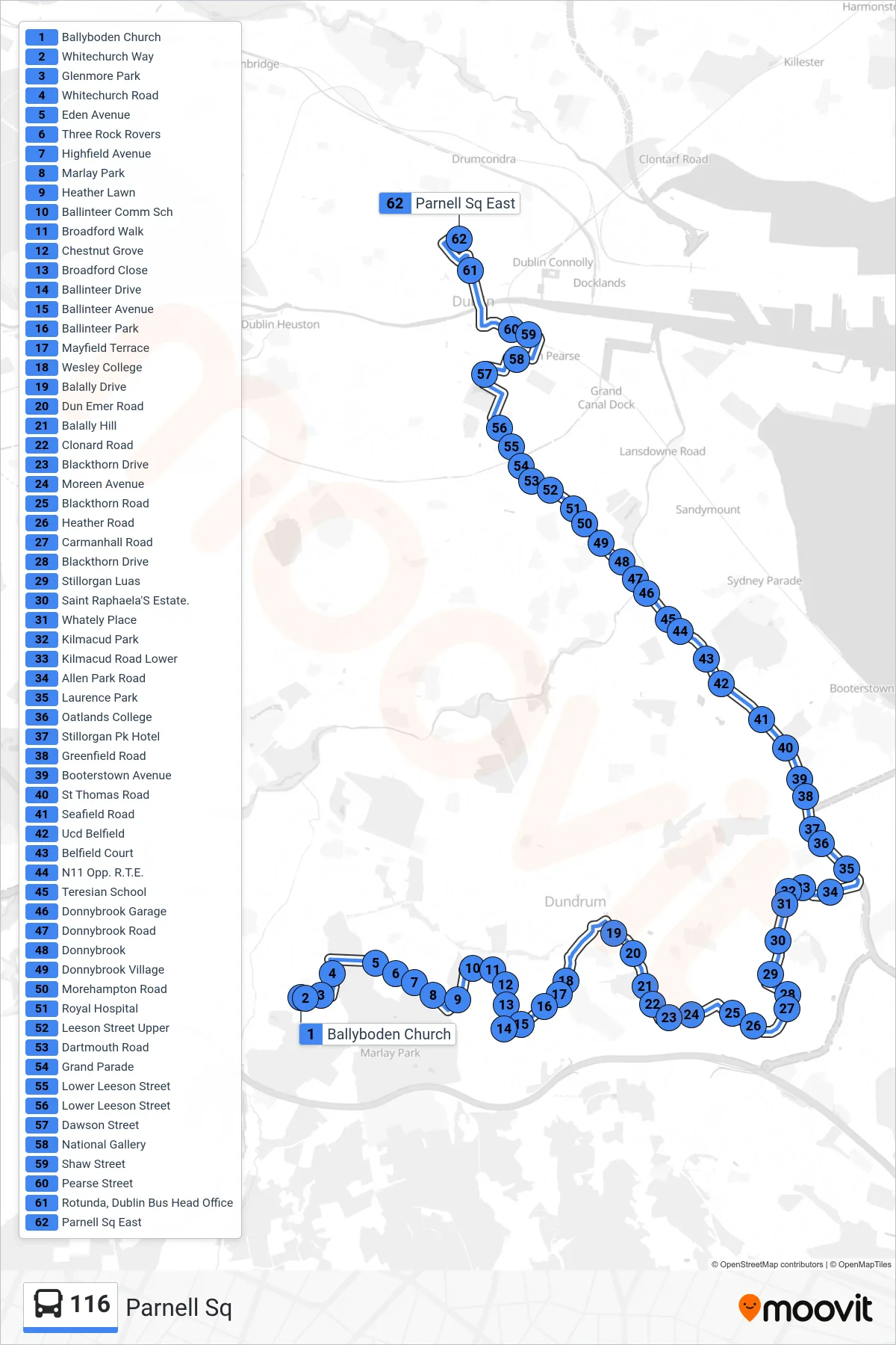
Stops list (116 - Parnell Sq)
- Ballyboden Church
- Whitechurch Way
- Glenmore Park
- Whitechurch Road
- Eden Avenue
- Three Rock Rovers
- Highfield Avenue
- Marlay Park
- Heather Lawn
- Ballinteer Comm Sch
- Broadford Walk
- Chestnut Grove
- Broadford Close
- Ballinteer Drive
- Ballinteer Avenue
- Ballinteer Park
- Mayfield Terrace
- Wesley College
- Balally Drive
- Dun Emer Road
- Balally Hill
- Clonard Road
- Blackthorn Drive
- Moreen Avenue
- Blackthorn Road
- Heather Road
- Carmanhall Road
- Blackthorn Drive
- Stillorgan Luas
- Saint Raphaela'S Estate.
- Whately Place
- Kilmacud Park
- Kilmacud Road Lower
- Allen Park Road
- Laurence Park
- Oatlands College
- Stillorgan Pk Hotel
- Greenfield Road
- Booterstown Avenue
- St Thomas Road
- Seafield Road
- Ucd Belfield
- Belfield Court
- N11 Opp. R.T.E.
- Teresian School
- Donnybrook Garage
- Donnybrook Road
- Donnybrook
- Donnybrook Village
- Morehampton Road
- Royal Hospital
- Leeson Street Upper
- Dartmouth Road
- Grand Parade
- Lower Leeson Street
- Lower Leeson Street
- Dawson Street
- National Gallery
- Shaw Street
- Pearse Street
- Rotunda, Dublin Bus Head Office
- Parnell Sq East