
116 Bus Route Map
View the 116 route map and see all 116 stops along the route. The map of 116 shows where the bus travels and the location of each stop, making it easy to understand the entire route at a glance.
Explore Nomad Car (Région Normandie) routes on the map and see where Nomad Car (Région Normandie) bus services operate. Use the 116 map to find bus stops and see how the 116 connects different areas along its trip.
All 116 stops on the map are displayed in route order, helping you follow the 116 bus from the first stop to the last.
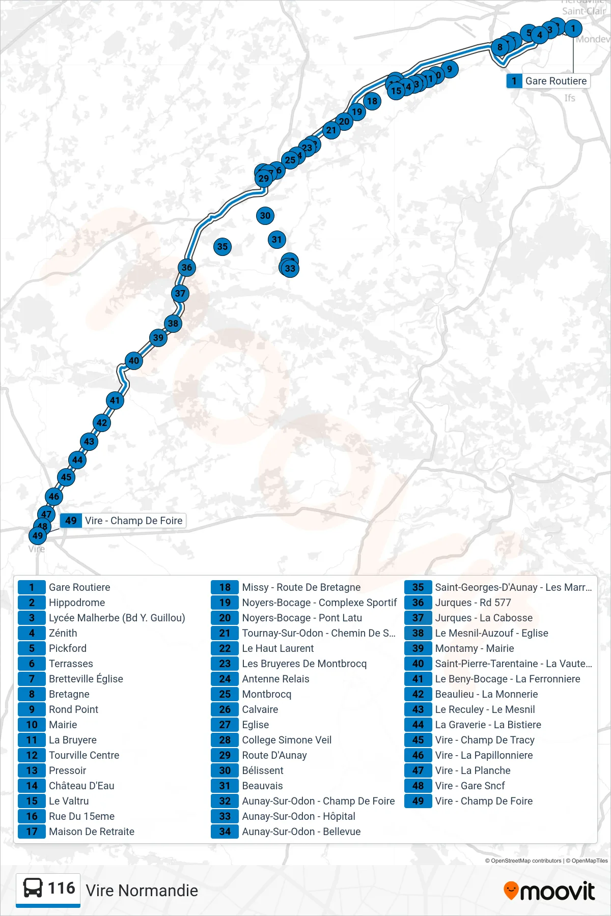
Stops list (116 - Vire Normandie)
- Gare Routiere
- Hippodrome
- Lycée Malherbe (Bd Y. Guillou)
- Zénith
- Pickford
- Terrasses
- Bretteville Église
- Bretagne
- Rond Point
- Mairie
- La Bruyere
- Tourville Centre
- Pressoir
- Château D'Eau
- Le Valtru
- Rue Du 15eme
- Maison De Retraite
- Missy - Route De Bretagne
- Noyers-Bocage - Complexe Sportif
- Noyers-Bocage - Pont Latu
- Tournay-Sur-Odon - Chemin De Sallen
- Le Haut Laurent
- Les Bruyeres De Montbrocq
- Antenne Relais
- Montbrocq
- Calvaire
- Eglise
- College Simone Veil
- Route D'Aunay
- Bélissent
- Beauvais
- Aunay-Sur-Odon - Champ De Foire
- Aunay-Sur-Odon - Hôpital
- Aunay-Sur-Odon - Bellevue
- Saint-Georges-D'Aunay - Les Marronniers
- Jurques - Rd 577
- Jurques - La Cabosse
- Le Mesnil-Auzouf - Eglise
- Montamy - Mairie
- Saint-Pierre-Tarentaine - La Vauteliere
- Le Beny-Bocage - La Ferronniere
- Beaulieu - La Monnerie
- Le Reculey - Le Mesnil
- La Graverie - La Bistiere
- Vire - Champ De Tracy
- Vire - La Papillonniere
- Vire - La Planche
- Vire - Gare Sncf
- Vire - Champ De Foire