
117 Bus Route Map
View the 117 route map and see all 117 stops along the route. The map of 117 shows where the bus travels and the location of each stop, making it easy to understand the entire route at a glance.
Explore SamTrans routes on the map and see where SamTrans bus services operate. Use the 117 map to find bus stops and see how the 117 connects different areas along its trip.
All 117 stops on the map are displayed in route order, helping you follow the 117 bus from the first stop to the last.
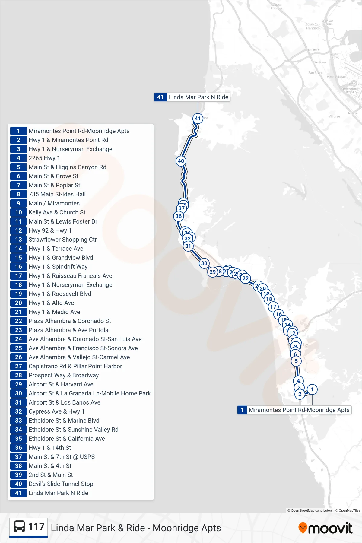
Stops list (117 - Pacifica)
- Miramontes Point Rd-Moonridge Apts
- Hwy 1 & Miramontes Point Rd
- Hwy 1 & Nurseryman Exchange
- 2265 Hwy 1
- Main St & Higgins Canyon Rd
- Main St & Grove St
- Main St & Poplar St
- 735 Main St-Ides Hall
- Main / Miramontes
- Kelly Ave & Church St
- Main St & Lewis Foster Dr
- Hwy 92 & Hwy 1
- Strawflower Shopping Ctr
- Hwy 1 & Terrace Ave
- Hwy 1 & Grandview Blvd
- Hwy 1 & Spindrift Way
- Hwy 1 & Ruisseau Francais Ave
- Hwy 1 & Nurseryman Exchange
- Hwy 1 & Roosevelt Blvd
- Hwy 1 & Alto Ave
- Hwy 1 & Medio Ave
- Plaza Alhambra & Coronado St
- Plaza Alhambra & Ave Portola
- Ave Alhambra & Coronado St-San Luis Ave
- Ave Alhambra & Francisco St-Sonora Ave
- Ave Alhambra & Vallejo St-Carmel Ave
- Capistrano Rd & Pillar Point Harbor
- Prospect Way & Broadway
- Airport St & Harvard Ave
- Airport St & La Granada Ln-Mobile Home Park
- Airport St & Los Banos Ave
- Cypress Ave & Hwy 1
- Etheldore St & Marine Blvd
- Etheldore St & Sunshine Valley Rd
- Etheldore St & California Ave
- Hwy 1 & 14th St
- Main St & 7th St @ USPS
- Main St & 4th St
- 2nd St & Main St
- Devil's Slide Tunnel Stop
- Linda Mar Park N Ride