
118 Bus Route Map
View the 118 route map and see all 118 stops along the route. The map of 118 shows where the bus travels and the location of each stop, making it easy to understand the entire route at a glance.
Explore KP Kyivpastrans routes on the map and see where KP Kyivpastrans bus services operate. Use the 118 map to find bus stops and see how the 118 connects different areas along its trip.
All 118 stops on the map are displayed in route order, helping you follow the 118 bus from the first stop to the last.
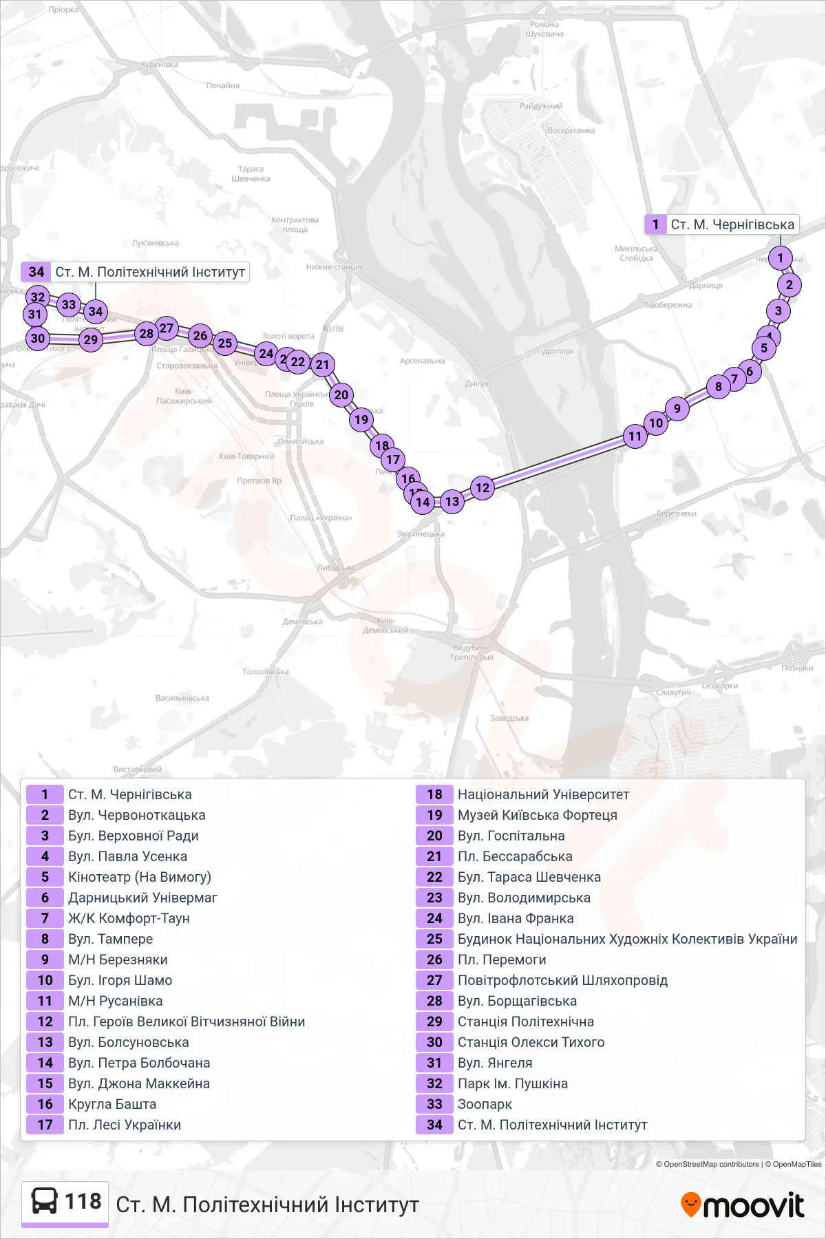
Stops list (118 - Metro Station Polytechnic Institute)
- Chernihivska Metro Station
- Chervonotkatska Street
- Verkhovnoi Rady Blvd
- Pavla Usenka St
- Cinema (On Demand)
- Darnytskyi Department Store
- Comfort Town Complex
- Tampere Street
- Berezniaky District
- Igor Shamo Boulevard
- Rusanivka District
- Great Patriotic War Heroes Square
- Bolsunovska Street
- Petro Bolbochan Street
- John McCain St
- Round Tower
- Lesya Ukrainka Square
- National University
- Kyiv Fortress Museum
- Hospital Street
- Bessarabska Square
- Taras Shevchenko Blvd
- Volodymyrska St
- Ivan Franko St
- House of National Art Collectives of Ukraine
- Victory Square
- Povitroflotskyi Overpass
- Borshchahivska St
- Politekhnichnaya Station
- Oleksy Tykhoho Station
- Yangelia Street
- Pushkin Park
- Zoo
- Metro Station Polytechnic Institute