
119 Bus Route Map
View the 119 route map and see all 119 stops along the route. The map of 119 shows where the bus travels and the location of each stop, making it easy to understand the entire route at a glance.
Explore KP Kyivpastrans routes on the map and see where KP Kyivpastrans bus services operate. Use the 119 map to find bus stops and see how the 119 connects different areas along its trip.
All 119 stops on the map are displayed in route order, helping you follow the 119 bus from the first stop to the last.
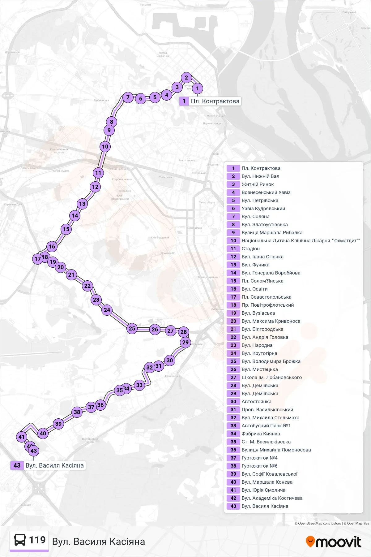
Stops list (119 - Vasyl Kasiyan Street)
- Kontraktova Square
- Nyzhnii Val Street
- Zhytniy Market
- Voznesenskyi Descent
- Petrivska Street
- Kudriavskyi Descent
- Soliana Street
- Zlatoustivska Street
- Marshal Rybalka Street
- National Children's Clinical Hospital "Okhmatdyt"
- Stadium
- Ivan Ohiienko Street
- Fuchik Street
- General Vorobiov Street
- Solomyanska Square
- Osvity Street
- Sevastopolska Square
- Povitroflotsky Ave
- Vuzivska St
- Maksyma Kryvonosa Street
- Bilhorodska St
- Andriia Holovka St
- Narodna Street
- Krutohirna Street
- Volodymyr Brozhko Street
- Mystetska Street
- Lobanovskyi School
- Demiivska Street
- Demiivska Street
- Parking Lot
- Vasylkivskyi Lane
- Mykhailo Stelmakh Street
- Bus Park #1
- Kyianka Factory
- Vasylkivska Metro Station
- Mikhail Lomonosov Street
- Dormitory #4
- Dormitory #6
- Sofia Kovalevska Street
- Marshal Konev Street
- Yuriy Smolych Street
- Academician Kostychev St.
- Vasyl Kasiyan Street