
12 Bus Route Map
View the 12 route map and see all 12 stops along the route. The map of 12 shows where the bus travels and the location of each stop, making it easy to understand the entire route at a glance.
Explore Cottbusverkehr routes on the map and see where Cottbusverkehr bus services operate. Use the 12 map to find bus stops and see how the 12 connects different areas along its trip.
All 12 stops on the map are displayed in route order, helping you follow the 12 bus from the first stop to the last.
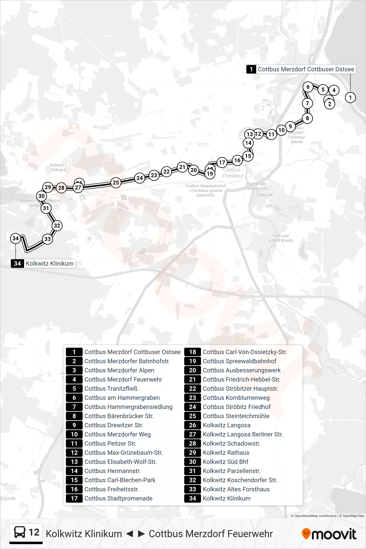
Stops list (12 - Kolkwitz Klinikum)
- Cottbus Merzdorf Cottbuser Ostsee
- Cottbus Merzdorfer Bahnhofstr.
- Cottbus Merzdorfer Alpen
- Cottbus Merzdorf Feuerwehr
- Cottbus Tranitzfließ
- Cottbus am Hammergraben
- Cottbus Hammergrabensiedlung
- Cottbus Bärenbrücker Str.
- Cottbus Drewitzer Str.
- Cottbus Merzdorfer Weg
- Cottbus Peitzer Str.
- Cottbus Max-Grünebaum-Str.
- Cottbus Elisabeth-Wolf-Str.
- Cottbus Hermannstr.
- Cottbus Carl-Blechen-Park
- Cottbus Freiheitsstr.
- Cottbus Stadtpromenade
- Cottbus Carl-Von-Ossietzky-Str.
- Cottbus Spreewaldbahnhof
- Cottbus Ausbesserungswerk
- Cottbus Friedrich-Hebbel-Str.
- Cottbus Ströbitzer Hauptstr.
- Cottbus Kornblumenweg
- Cottbus Ströbitz Friedhof
- Cottbus Steinteichmühle
- Kolkwitz Langosa
- Kolkwitz Langosa Berliner Str.
- Kolkwitz Schadowstr.
- Kolkwitz Rathaus
- Kolkwitz Süd Bhf
- Kolkwitz Parzellenstr.
- Kolkwitz Koschendorfer Str.
- Kolkwitz Altes Forsthaus
- Kolkwitz Klinikum
Change direction
- Route Map - 12 - Cottbus Stadtpromenade
- Route Map - 12 - Cottbus Hammergrabensiedlung
- Route Map - 12 - Kolkwitz Rathaus
- Route Map - 12 - Cottbus Merzdorf Cottbuser Ostsee
- Route Map - 12 - Cottbus Stadtpromenade
- Route Map - 12 - Cottbus Peitzer Str.
- Route Map - 12 - Kolkwitz Technologiepark
- Route Map - 12 - Cottbus Merzdorf Feuerwehr
- Route Map - 12 - Kolkwitz Rathaus