
12 Bus Route Map
View the 12 route map and see all 12 stops along the route. The map of 12 shows where the bus travels and the location of each stop, making it easy to understand the entire route at a glance.
Explore Lowell Regional Transit Authority routes on the map and see where Lowell Regional Transit Authority bus services operate. Use the 12 map to find bus stops and see how the 12 connects different areas along its trip.
All 12 stops on the map are displayed in route order, helping you follow the 12 bus from the first stop to the last.
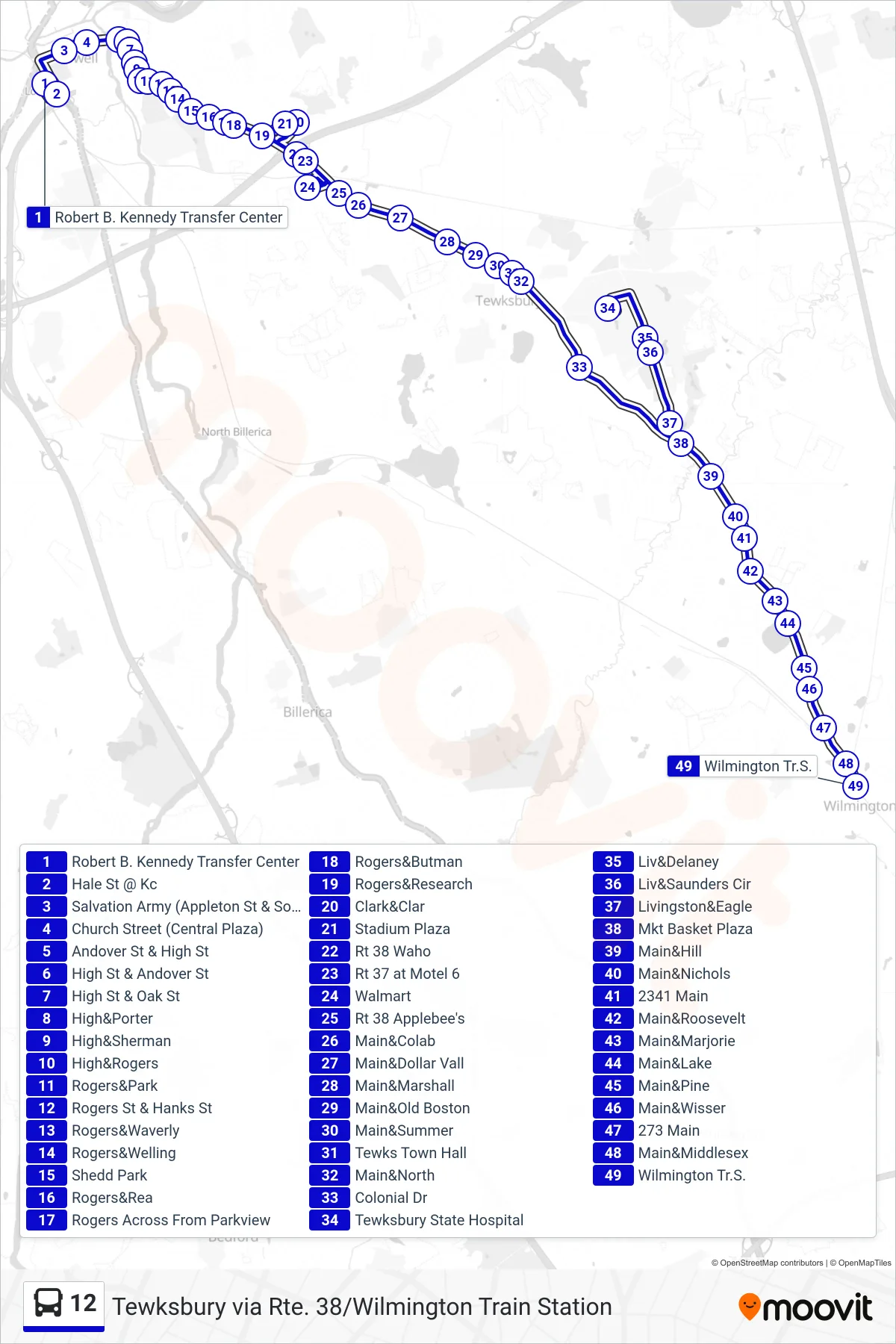
Stops list (12 - Tewksbury Via Rte. 38/Wilmington Train Station)
- Robert B. Kennedy Transfer Center
- Hale St @ Kc
- Salvation Army (Appleton St & South St)
- Church Street (Central Plaza)
- Andover St & High St
- High St & Andover St
- High St & Oak St
- High&Porter
- High&Sherman
- High&Rogers
- Rogers&Park
- Rogers St & Hanks St
- Rogers&Waverly
- Rogers&Welling
- Shedd Park
- Rogers&Rea
- Rogers Across From Parkview
- Rogers&Butman
- Rogers&Research
- Clark&Clar
- Stadium Plaza
- Rt 38 Waho
- Rt 37 at Motel 6
- Walmart
- Rt 38 Applebee's
- Main&Colab
- Main&Dollar Vall
- Main&Marshall
- Main&Old Boston
- Main&Summer
- Tewks Town Hall
- Main&North
- Colonial Dr
- Tewksbury State Hospital
- Liv&Delaney
- Liv&Saunders Cir
- Livingston&Eagle
- Mkt Basket Plaza
- Main&Hill
- Main&Nichols
- 2341 Main
- Main&Roosevelt
- Main&Marjorie
- Main&Lake
- Main&Pine
- Main&Wisser
- 273 Main
- Main&Middlesex
- Wilmington Tr.S.