
12 Light Rail Route Map
View the 12 route map and see all 12 stops along the route. The map of 12 shows where the light rail travels and the location of each stop, making it easy to understand the entire route at a glance.
Explore KP Kyivpastrans routes on the map and see where KP Kyivpastrans light rail services operate. Use the 12 map to find light rail stations and see how the 12 connects different areas along its trip.
All 12 stops on the map are displayed in route order, helping you follow the 12 light rail from the first station to the last.
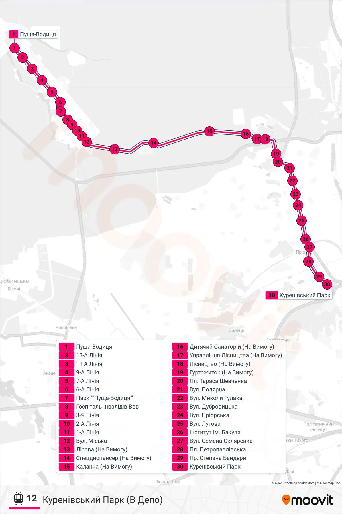
Stops list (12 - Kurenivskyi Park (To Depot))
- Pushcha-Vodytsia
- 13-A Line
- 11-A Line
- 9-A Line
- 7-A Line
- 6-A Line
- Pushcha-Vodytsia Park
- Hospital for WWW Invalids
- 3rd Line
- 2-A Line
- 1-A Line
- Miska Street
- Lisova (On Demand)
- Special Dispensary (On Demand)
- Kalancha (On Request)
- Children's Sanatorium (On Demand)
- Forestry Office (On Demand)
- Forestry (On Demand)
- Dormitory (On Demand)
- Taras Shevchenko Square
- Poliarna St.
- Mykoly Hulaka Street
- Dubrovytska Street
- Priorska Street
- Luhova Street
- Bakul Institute
- Semen Sklyarenko St.
- Petropavlivska Square
- Stepana Bandery Ave
- Kurenivsky Park