
12 Bus Route Map
View the 12 route map and see all 12 stops along the route. The map of 12 shows where the bus travels and the location of each stop, making it easy to understand the entire route at a glance.
Explore C-TRAN routes on the map and see where C-TRAN bus services operate. Use the 12 map to find bus stops and see how the 12 connects different areas along its trip.
All 12 stops on the map are displayed in route order, helping you follow the 12 bus from the first stop to the last.
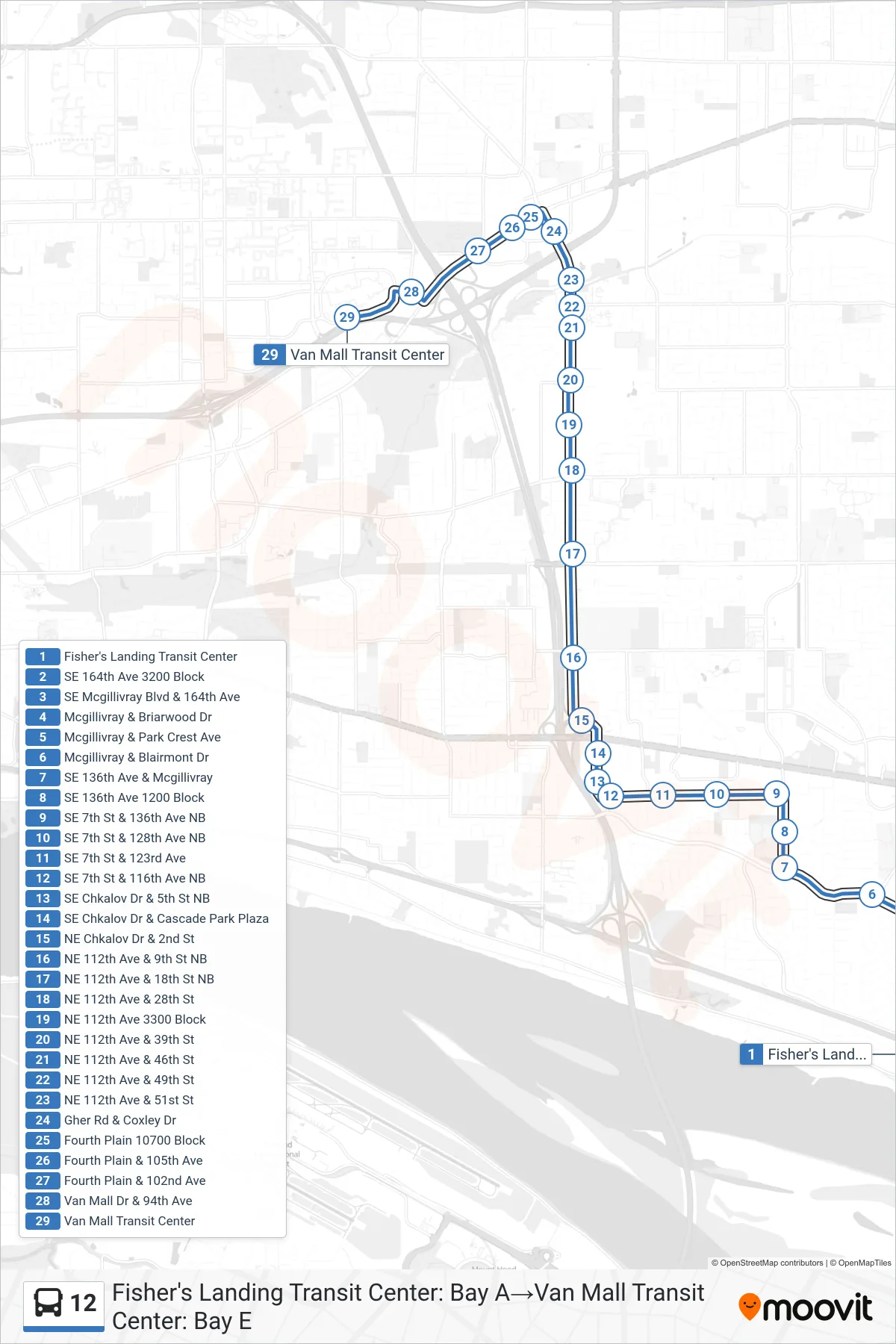
Stops list (12 - Fisher's Landing Transit Center: Bay A→Van Mall Transit Center: Bay E)
- Fisher's Landing Transit Center
- SE 164th Ave 3200 Block
- SE Mcgillivray Blvd & 164th Ave
- Mcgillivray & Briarwood Dr
- Mcgillivray & Park Crest Ave
- Mcgillivray & Blairmont Dr
- SE 136th Ave & Mcgillivray
- SE 136th Ave 1200 Block
- SE 7th St & 136th Ave NB
- SE 7th St & 128th Ave NB
- SE 7th St & 123rd Ave
- SE 7th St & 116th Ave NB
- SE Chkalov Dr & 5th St NB
- SE Chkalov Dr & Cascade Park Plaza
- NE Chkalov Dr & 2nd St
- NE 112th Ave & 9th St NB
- NE 112th Ave & 18th St NB
- NE 112th Ave & 28th St
- NE 112th Ave 3300 Block
- NE 112th Ave & 39th St
- NE 112th Ave & 46th St
- NE 112th Ave & 49th St
- NE 112th Ave & 51st St
- Gher Rd & Coxley Dr
- Fourth Plain 10700 Block
- Fourth Plain & 105th Ave
- Fourth Plain & 102nd Ave
- Van Mall Dr & 94th Ave
- Van Mall Transit Center