
12 Bus Route Map
View the 12 route map and see all 12 stops along the route. The map of 12 shows where the bus travels and the location of each stop, making it easy to understand the entire route at a glance.
Explore GoRaleigh routes on the map and see where GoRaleigh bus services operate. Use the 12 map to find bus stops and see how the 12 connects different areas along its trip.
All 12 stops on the map are displayed in route order, helping you follow the 12 bus from the first stop to the last.
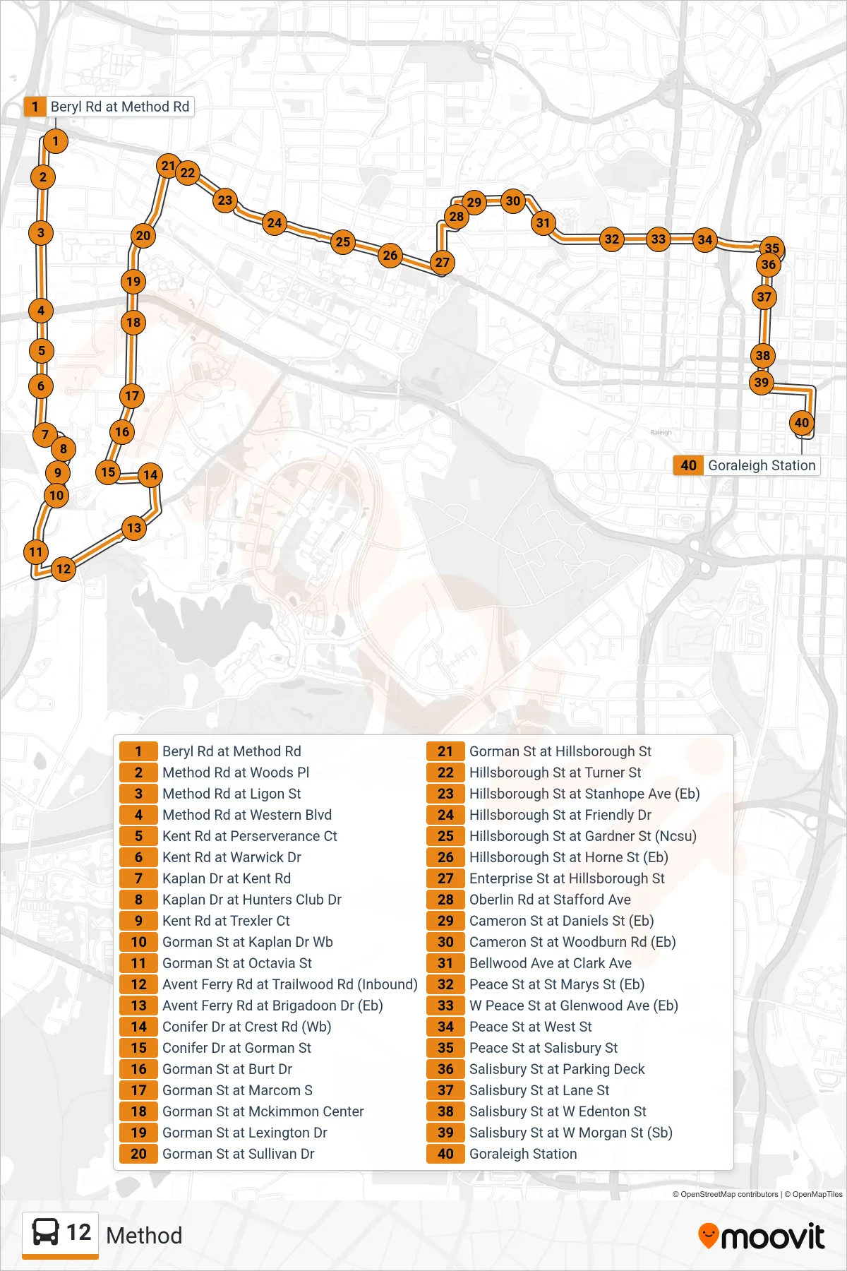
Stops list (12 - Beryl Rd at Method Rd→Goraleigh Station)
- Beryl Rd at Method Rd
- Method Rd at Woods Pl
- Method Rd at Ligon St
- Method Rd at Western Blvd
- Kent Rd at Perserverance Ct
- Kent Rd at Warwick Dr
- Kaplan Dr at Kent Rd
- Kaplan Dr at Hunters Club Dr
- Kent Rd at Trexler Ct
- Gorman St at Kaplan Dr Wb
- Gorman St at Octavia St
- Avent Ferry Rd at Trailwood Rd (Inbound)
- Avent Ferry Rd at Brigadoon Dr (Eb)
- Conifer Dr at Crest Rd (Wb)
- Conifer Dr at Gorman St
- Gorman St at Burt Dr
- Gorman St at Marcom S
- Gorman St at Mckimmon Center
- Gorman St at Lexington Dr
- Gorman St at Sullivan Dr
- Gorman St at Hillsborough St
- Hillsborough St at Turner St
- Hillsborough St at Stanhope Ave (Eb)
- Hillsborough St at Friendly Dr
- Hillsborough St at Gardner St (Ncsu)
- Hillsborough St at Horne St (Eb)
- Enterprise St at Hillsborough St
- Oberlin Rd at Stafford Ave
- Cameron St at Daniels St (Eb)
- Cameron St at Woodburn Rd (Eb)
- Bellwood Ave at Clark Ave
- Peace St at St Marys St (Eb)
- W Peace St at Glenwood Ave (Eb)
- Peace St at West St
- Peace St at Salisbury St
- Salisbury St at Parking Deck
- Salisbury St at Lane St
- Salisbury St at W Edenton St
- Salisbury St at W Morgan St (Sb)
- Goraleigh Station