
12 Bus Route Map
View the 12 route map and see all 12 stops along the route. The map of 12 shows where the bus travels and the location of each stop, making it easy to understand the entire route at a glance.
Explore WestCat (Western Contra Costa) routes on the map and see where WestCat (Western Contra Costa) bus services operate. Use the 12 map to find bus stops and see how the 12 connects different areas along its trip.
All 12 stops on the map are displayed in route order, helping you follow the 12 bus from the first stop to the last.
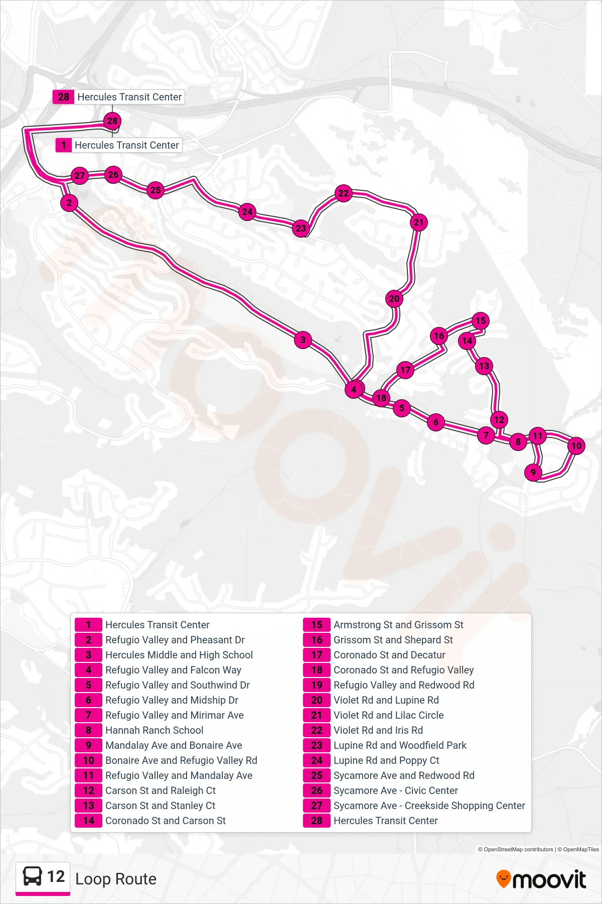
Stops list (12 - Loop Route)
- Hercules Transit Center
- Refugio Valley and Pheasant Dr
- Hercules Middle and High School
- Refugio Valley and Falcon Way
- Refugio Valley and Southwind Dr
- Refugio Valley and Midship Dr
- Refugio Valley and Mirimar Ave
- Hannah Ranch School
- Mandalay Ave and Bonaire Ave
- Bonaire Ave and Refugio Valley Rd
- Refugio Valley and Mandalay Ave
- Carson St and Raleigh Ct
- Carson St and Stanley Ct
- Coronado St and Carson St
- Armstrong St and Grissom St
- Grissom St and Shepard St
- Coronado St and Decatur
- Coronado St and Refugio Valley
- Refugio Valley and Redwood Rd
- Violet Rd and Lupine Rd
- Violet Rd and Lilac Circle
- Violet Rd and Iris Rd
- Lupine Rd and Woodfield Park
- Lupine Rd and Poppy Ct
- Sycamore Ave and Redwood Rd
- Sycamore Ave - Civic Center
- Sycamore Ave - Creekside Shopping Center
- Hercules Transit Center