
12 Bus Route Map
View the 12 route map and see all 12 stops along the route. The map of 12 shows where the bus travels and the location of each stop, making it easy to understand the entire route at a glance.
Explore SWU routes on the map and see where SWU bus services operate. Use the 12 map to find bus stops and see how the 12 connects different areas along its trip.
All 12 stops on the map are displayed in route order, helping you follow the 12 bus from the first stop to the last.
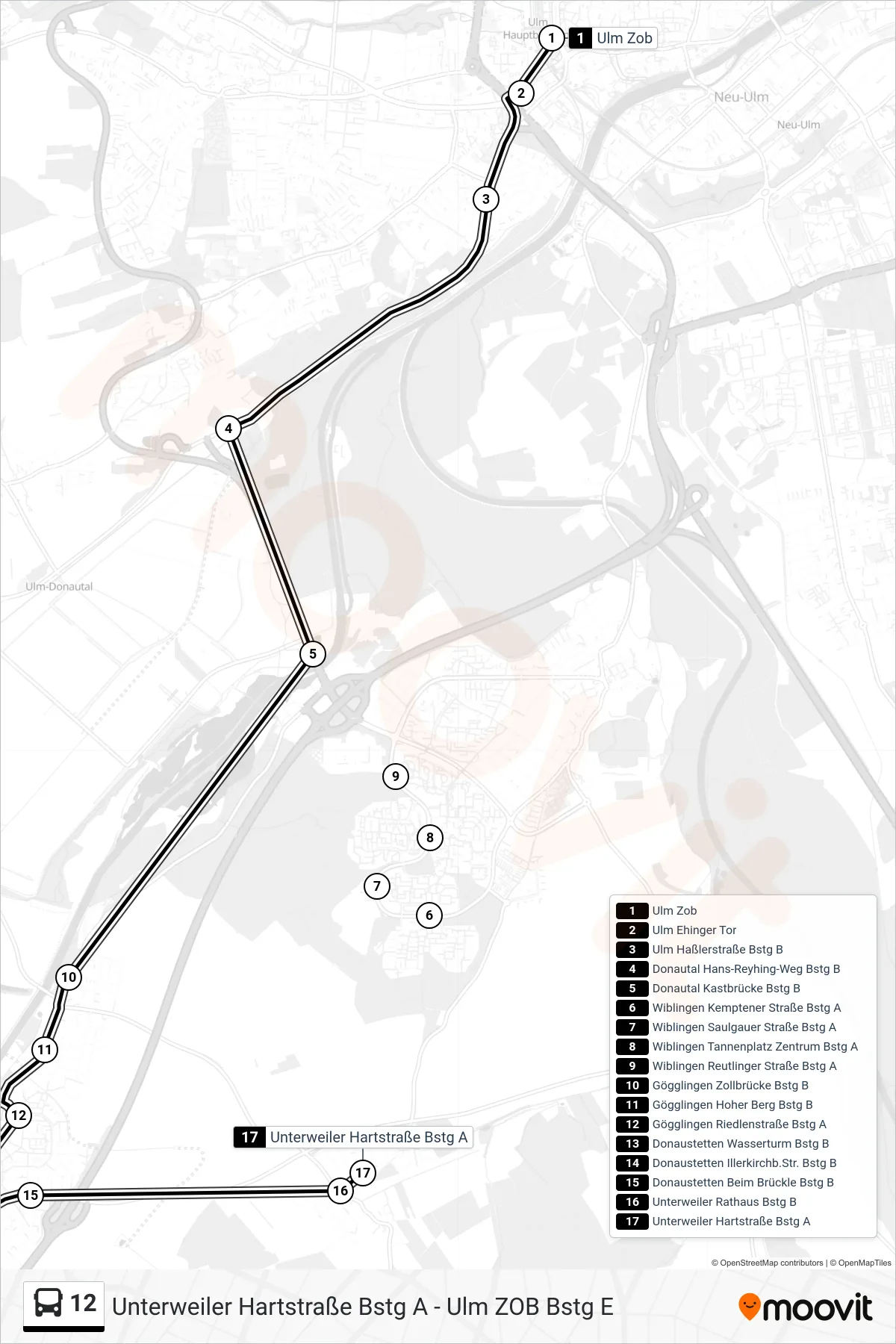
Stops list (12 - Unterweiler Hartstraße)
- Ulm Zob
- Ulm Ehinger Tor
- Ulm Haßlerstraße Bstg B
- Donautal Hans-Reyhing-Weg Bstg B
- Donautal Kastbrücke Bstg B
- Wiblingen Kemptener Straße Bstg A
- Wiblingen Saulgauer Straße Bstg A
- Wiblingen Tannenplatz Zentrum Bstg A
- Wiblingen Reutlinger Straße Bstg A
- Gögglingen Zollbrücke Bstg B
- Gögglingen Hoher Berg Bstg B
- Gögglingen Riedlenstraße Bstg A
- Donaustetten Wasserturm Bstg B
- Donaustetten Illerkirchb.Str. Bstg B
- Donaustetten Beim Brückle Bstg B
- Unterweiler Rathaus Bstg B
- Unterweiler Hartstraße Bstg A